You are here: Home > Network List > UW - Pacific Northwest Regional Seismic Network Stations List
> Station UMAT Pilot Rock, OR, USA > Earthquake Result Viewer
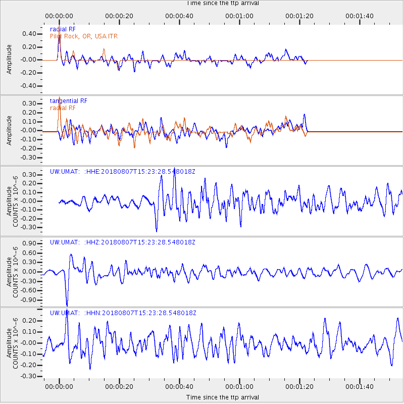
UMAT Pilot Rock, OR, USA - Earthquake Result Viewer
*The percent match for this event was below the threshold and hence no stack was calculated.
| Earthquake location: |
Off East Coast Of Honshu, Japan |
| Earthquake latitude/longitude: |
37.9/144.1 |
| Earthquake time(UTC): |
2018/08/07 (219) 15:12:57 GMT |
| Earthquake Depth: |
12 km |
| Earthquake Magnitude: |
5.6 Mww |
| Earthquake Catalog/Contributor: |
NEIC PDE/us |
|
| Network: |
UW Pacific Northwest Regional Seismic Network |
| Station: |
UMAT Pilot Rock, OR, USA |
| Lat/Lon: |
45.29 N/118.96 W |
| Elevation: |
1318 m |
|
| Distance: |
68.6 deg |
| Az: |
48.821 deg |
| Baz: |
302.464 deg |
| Ray Param: |
$rayparam |
*The percent match for this event was below the threshold and hence was not used in the summary stack. |
|
| Radial Match: |
70.03892 % |
| Radial Bump: |
376 |
| Transverse Match: |
64.90728 % |
| Transverse Bump: |
400 |
| SOD ConfigId: |
13570011 |
| Insert Time: |
2019-04-30 17:55:43.198 +0000 |
| GWidth: |
2.5 |
| Max Bumps: |
400 |
| Tol: |
0.001 |
|
Signal To Noise
| Channel | StoN | STA | LTA |
| UW:UMAT: :HHZ:20180807T15:23:28.548018Z | 7.482182 | 4.2158348E-7 | 5.6344994E-8 |
| UW:UMAT: :HHN:20180807T15:23:28.548018Z | 2.2262812 | 1.15654984E-7 | 5.194985E-8 |
| UW:UMAT: :HHE:20180807T15:23:28.548018Z | 3.7864022 | 1.5489223E-7 | 4.0907498E-8 |
| Arrivals |
| Ps | |
| PpPs | |
| PsPs/PpSs | |


