You are here: Home > Network List > TA - USArray Transportable Network (new EarthScope stations) Stations List
> Station L15A Malad City, ID, USA > Earthquake Result Viewer
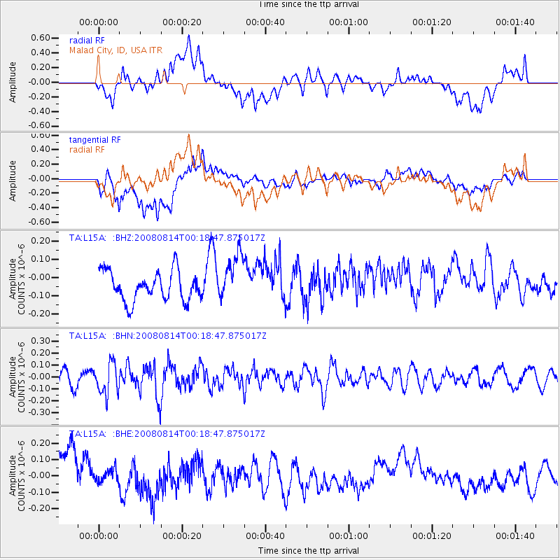
L15A Malad City, ID, USA - Earthquake Result Viewer
*The percent match for this event was below the threshold and hence no stack was calculated.
| Earthquake location: |
Mariana Islands |
| Earthquake latitude/longitude: |
16.4/146.9 |
| Earthquake time(UTC): |
2008/08/14 (227) 00:06:40 GMT |
| Earthquake Depth: |
53 km |
| Earthquake Magnitude: |
5.5 MB, 4.8 MS |
| Earthquake Catalog/Contributor: |
WHDF/NEIC |
|
| Network: |
TA USArray Transportable Network (new EarthScope stations) |
| Station: |
L15A Malad City, ID, USA |
| Lat/Lon: |
42.00 N/112.39 W |
| Elevation: |
1646 m |
|
| Distance: |
86.9 deg |
| Az: |
47.182 deg |
| Baz: |
289.186 deg |
| Ray Param: |
$rayparam |
*The percent match for this event was below the threshold and hence was not used in the summary stack. |
|
| Radial Match: |
62.419178 % |
| Radial Bump: |
400 |
| Transverse Match: |
55.37118 % |
| Transverse Bump: |
400 |
| SOD ConfigId: |
2504 |
| Insert Time: |
2010-03-06 13:32:51.655 +0000 |
| GWidth: |
2.5 |
| Max Bumps: |
400 |
| Tol: |
0.001 |
|
Signal To Noise
| Channel | StoN | STA | LTA |
| TA:L15A: :BHN:20080814T00:18:47.875017Z | 2.0296133 | 1.3110376E-7 | 6.459544E-8 |
| TA:L15A: :BHE:20080814T00:18:47.875017Z | 0.3693299 | 3.93794E-8 | 1.06623915E-7 |
| TA:L15A: :BHZ:20080814T00:18:47.875017Z | 1.6676297 | 1.3482543E-7 | 8.084854E-8 |
| Arrivals |
| Ps | |
| PpPs | |
| PsPs/PpSs | |


