You are here: Home > Network List > TA - USArray Transportable Network (new EarthScope stations) Stations List
> Station G18A Lazy EL Ranch, Roscoe, MT, USA > Earthquake Result Viewer
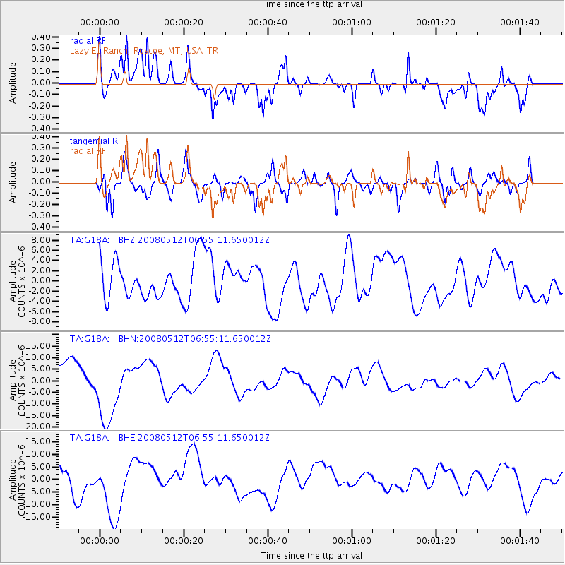
G18A Lazy EL Ranch, Roscoe, MT, USA - Earthquake Result Viewer
*The percent match for this event was below the threshold and hence no stack was calculated.
| Earthquake location: |
Sichuan, China |
| Earthquake latitude/longitude: |
31.3/104.7 |
| Earthquake time(UTC): |
2008/05/12 (133) 06:42:08 GMT |
| Earthquake Depth: |
10 km |
| Earthquake Magnitude: |
5.7 MB |
| Earthquake Catalog/Contributor: |
WHDF/NEIC |
|
| Network: |
TA USArray Transportable Network (new EarthScope stations) |
| Station: |
G18A Lazy EL Ranch, Roscoe, MT, USA |
| Lat/Lon: |
45.32 N/109.56 W |
| Elevation: |
1699 m |
|
| Distance: |
97.6 deg |
| Az: |
23.613 deg |
| Baz: |
330.938 deg |
| Ray Param: |
$rayparam |
*The percent match for this event was below the threshold and hence was not used in the summary stack. |
|
| Radial Match: |
64.186745 % |
| Radial Bump: |
400 |
| Transverse Match: |
74.90095 % |
| Transverse Bump: |
400 |
| SOD ConfigId: |
2504 |
| Insert Time: |
2010-03-06 13:34:32.780 +0000 |
| GWidth: |
2.5 |
| Max Bumps: |
400 |
| Tol: |
0.001 |
|
Signal To Noise
| Channel | StoN | STA | LTA |
| TA:G18A: :BHN:20080512T06:55:11.650012Z | 2.8460238 | 1.539341E-5 | 5.4087427E-6 |
| TA:G18A: :BHE:20080512T06:55:11.650012Z | 2.0528421 | 1.30858725E-5 | 6.3745147E-6 |
| TA:G18A: :BHZ:20080512T06:55:11.650012Z | 0.6110449 | 2.3349926E-6 | 3.821311E-6 |
| Arrivals |
| Ps | |
| PpPs | |
| PsPs/PpSs | |


