You are here: Home > Network List > TA - USArray Transportable Network (new EarthScope stations) Stations List
> Station R33M Jennings River, BC, CAN > Earthquake Result Viewer
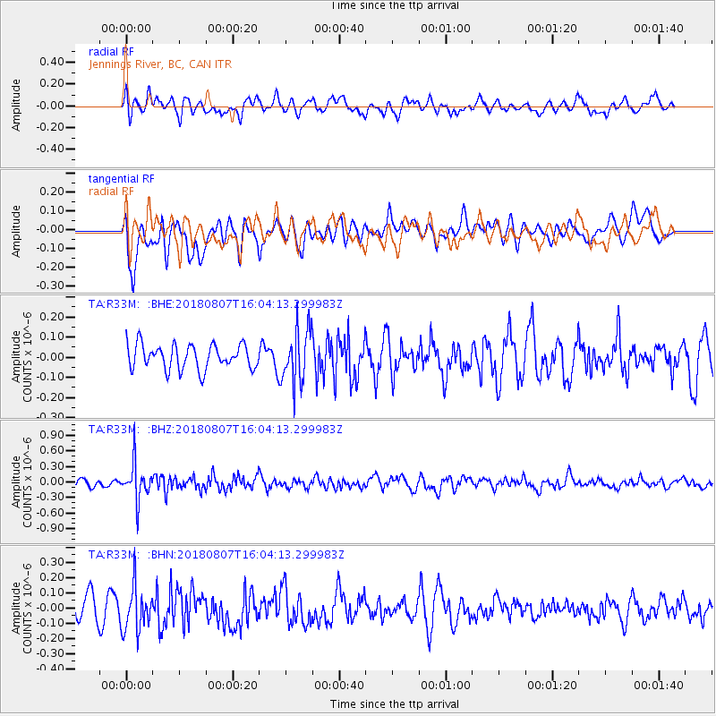
R33M Jennings River, BC, CAN - Earthquake Result Viewer
*The percent match for this event was below the threshold and hence no stack was calculated.
| Earthquake location: |
Northern Colombia |
| Earthquake latitude/longitude: |
6.8/-73.0 |
| Earthquake time(UTC): |
2018/08/07 (219) 15:53:59 GMT |
| Earthquake Depth: |
148 km |
| Earthquake Magnitude: |
5.6 mb |
| Earthquake Catalog/Contributor: |
NEIC PDE/us |
|
| Network: |
TA USArray Transportable Network (new EarthScope stations) |
| Station: |
R33M Jennings River, BC, CAN |
| Lat/Lon: |
59.39 N/130.97 W |
| Elevation: |
1437 m |
|
| Distance: |
68.3 deg |
| Az: |
332.161 deg |
| Baz: |
114.991 deg |
| Ray Param: |
$rayparam |
*The percent match for this event was below the threshold and hence was not used in the summary stack. |
|
| Radial Match: |
42.669346 % |
| Radial Bump: |
400 |
| Transverse Match: |
52.052128 % |
| Transverse Bump: |
400 |
| SOD ConfigId: |
13570011 |
| Insert Time: |
2019-04-30 18:06:50.914 +0000 |
| GWidth: |
2.5 |
| Max Bumps: |
400 |
| Tol: |
0.001 |
|
Signal To Noise
| Channel | StoN | STA | LTA |
| TA:R33M: :BHZ:20180807T16:04:13.299983Z | 2.4567785 | 3.604892E-7 | 1.4673248E-7 |
| TA:R33M: :BHN:20180807T16:04:13.299983Z | 1.4064832 | 1.4750711E-7 | 1.0487656E-7 |
| TA:R33M: :BHE:20180807T16:04:13.299983Z | 2.2450595 | 1.363946E-7 | 6.075322E-8 |
| Arrivals |
| Ps | |
| PpPs | |
| PsPs/PpSs | |


