You are here: Home > Network List > TA - USArray Transportable Network (new EarthScope stations) Stations List
> Station G18A Lazy EL Ranch, Roscoe, MT, USA > Earthquake Result Viewer
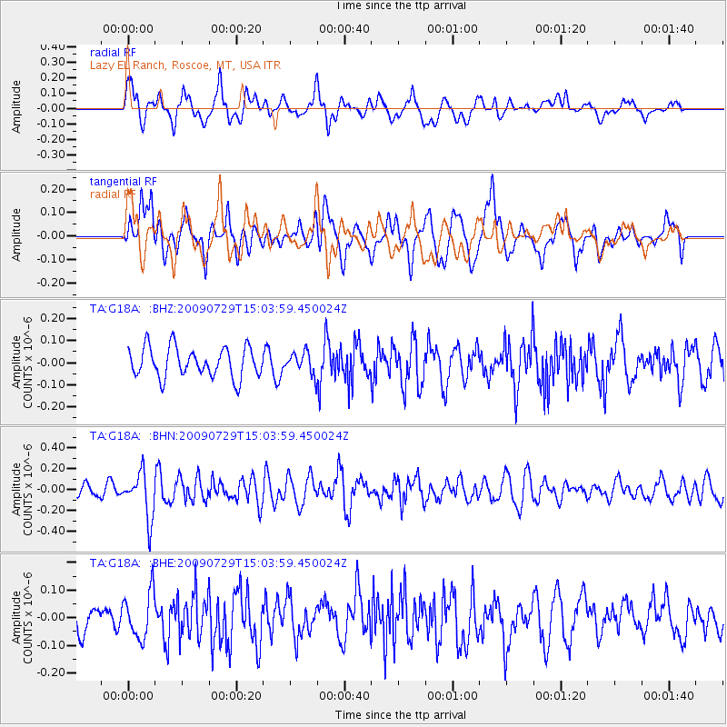
G18A Lazy EL Ranch, Roscoe, MT, USA - Earthquake Result Viewer
*The percent match for this event was below the threshold and hence no stack was calculated.
| Earthquake location: |
Volcano Islands, Japan Region |
| Earthquake latitude/longitude: |
22.6/143.3 |
| Earthquake time(UTC): |
2009/07/29 (210) 14:52:08 GMT |
| Earthquake Depth: |
140 km |
| Earthquake Magnitude: |
5.5 MW, 5.2 MB, 5.4 MW |
| Earthquake Catalog/Contributor: |
WHDF/NEIC |
|
| Network: |
TA USArray Transportable Network (new EarthScope stations) |
| Station: |
G18A Lazy EL Ranch, Roscoe, MT, USA |
| Lat/Lon: |
45.32 N/109.56 W |
| Elevation: |
1699 m |
|
| Distance: |
85.5 deg |
| Az: |
42.544 deg |
| Baz: |
297.652 deg |
| Ray Param: |
$rayparam |
*The percent match for this event was below the threshold and hence was not used in the summary stack. |
|
| Radial Match: |
55.32848 % |
| Radial Bump: |
400 |
| Transverse Match: |
46.42302 % |
| Transverse Bump: |
400 |
| SOD ConfigId: |
2622 |
| Insert Time: |
2010-03-06 13:35:04.157 +0000 |
| GWidth: |
2.5 |
| Max Bumps: |
400 |
| Tol: |
0.001 |
|
Signal To Noise
| Channel | StoN | STA | LTA |
| TA:G18A: :BHN:20090729T15:03:59.450024Z | 4.678663 | 2.2026198E-7 | 4.7077975E-8 |
| TA:G18A: :BHE:20090729T15:03:59.450024Z | 1.3368245 | 8.41262E-8 | 6.292987E-8 |
| TA:G18A: :BHZ:20090729T15:03:59.450024Z | 0.7356435 | 4.9574265E-8 | 6.738898E-8 |
| Arrivals |
| Ps | |
| PpPs | |
| PsPs/PpSs | |


