You are here: Home > Network List > UW - Pacific Northwest Regional Seismic Network Stations List
> Station UMAT Pilot Rock, OR, USA > Earthquake Result Viewer
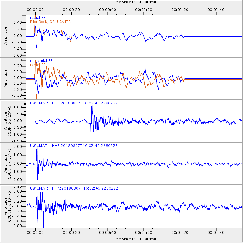
UMAT Pilot Rock, OR, USA - Earthquake Result Viewer
*The percent match for this event was below the threshold and hence no stack was calculated.
| Earthquake location: |
Northern Colombia |
| Earthquake latitude/longitude: |
6.8/-73.0 |
| Earthquake time(UTC): |
2018/08/07 (219) 15:53:59 GMT |
| Earthquake Depth: |
148 km |
| Earthquake Magnitude: |
5.6 mb |
| Earthquake Catalog/Contributor: |
NEIC PDE/us |
|
| Network: |
UW Pacific Northwest Regional Seismic Network |
| Station: |
UMAT Pilot Rock, OR, USA |
| Lat/Lon: |
45.29 N/118.96 W |
| Elevation: |
1318 m |
|
| Distance: |
55.2 deg |
| Az: |
321.84 deg |
| Baz: |
119.63 deg |
| Ray Param: |
$rayparam |
*The percent match for this event was below the threshold and hence was not used in the summary stack. |
|
| Radial Match: |
52.779064 % |
| Radial Bump: |
400 |
| Transverse Match: |
65.19724 % |
| Transverse Bump: |
400 |
| SOD ConfigId: |
13570011 |
| Insert Time: |
2019-04-30 18:07:54.347 +0000 |
| GWidth: |
2.5 |
| Max Bumps: |
400 |
| Tol: |
0.001 |
|
Signal To Noise
| Channel | StoN | STA | LTA |
| UW:UMAT: :HHZ:20180807T16:02:46.228022Z | 9.080609 | 7.117947E-7 | 7.838623E-8 |
| UW:UMAT: :HHN:20180807T16:02:46.228022Z | 4.1517253 | 3.065116E-7 | 7.382752E-8 |
| UW:UMAT: :HHE:20180807T16:02:46.228022Z | 6.0381665 | 5.2302505E-7 | 8.661985E-8 |
| Arrivals |
| Ps | |
| PpPs | |
| PsPs/PpSs | |


