You are here: Home > Network List > TA - USArray Transportable Network (new EarthScope stations) Stations List
> Station G18A Lazy EL Ranch, Roscoe, MT, USA > Earthquake Result Viewer
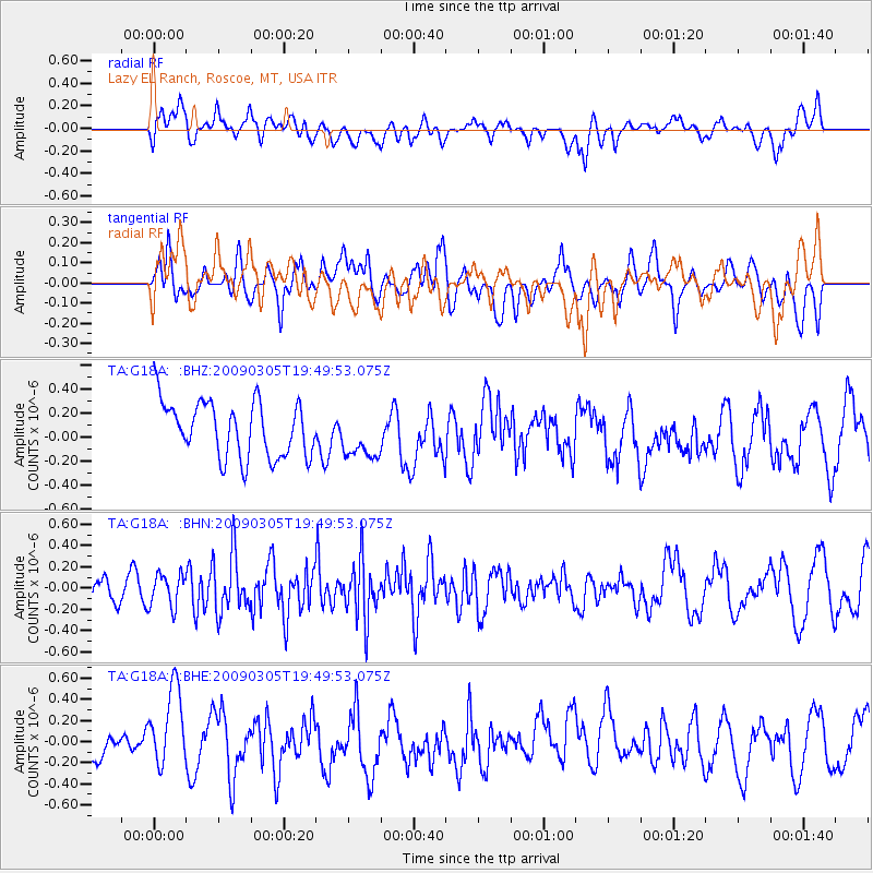
G18A Lazy EL Ranch, Roscoe, MT, USA - Earthquake Result Viewer
*The percent match for this event was below the threshold and hence no stack was calculated.
| Earthquake location: |
North Of Svalbard |
| Earthquake latitude/longitude: |
80.3/-1.8 |
| Earthquake time(UTC): |
2009/03/05 (064) 19:41:40 GMT |
| Earthquake Depth: |
10 km |
| Earthquake Magnitude: |
5.5 MB, 5.0 MS, 5.4 MW |
| Earthquake Catalog/Contributor: |
WHDF/NEIC |
|
| Network: |
TA USArray Transportable Network (new EarthScope stations) |
| Station: |
G18A Lazy EL Ranch, Roscoe, MT, USA |
| Lat/Lon: |
45.32 N/109.56 W |
| Elevation: |
1699 m |
|
| Distance: |
48.6 deg |
| Az: |
296.299 deg |
| Baz: |
12.465 deg |
| Ray Param: |
$rayparam |
*The percent match for this event was below the threshold and hence was not used in the summary stack. |
|
| Radial Match: |
43.295742 % |
| Radial Bump: |
400 |
| Transverse Match: |
40.0814 % |
| Transverse Bump: |
400 |
| SOD ConfigId: |
2658 |
| Insert Time: |
2010-03-06 13:35:33.163 +0000 |
| GWidth: |
2.5 |
| Max Bumps: |
400 |
| Tol: |
0.001 |
|
Signal To Noise
| Channel | StoN | STA | LTA |
| TA:G18A: :BHN:20090305T19:49:53.075Z | 1.4297837 | 1.5413698E-7 | 1.0780441E-7 |
| TA:G18A: :BHE:20090305T19:49:53.075Z | 2.0060725 | 3.9553802E-7 | 1.9717037E-7 |
| TA:G18A: :BHZ:20090305T19:49:53.075Z | 0.86374784 | 1.9941689E-7 | 2.3087398E-7 |
| Arrivals |
| Ps | |
| PpPs | |
| PsPs/PpSs | |


