You are here: Home > Network List > TA - USArray Transportable Network (new EarthScope stations) Stations List
> Station G18A Lazy EL Ranch, Roscoe, MT, USA > Earthquake Result Viewer
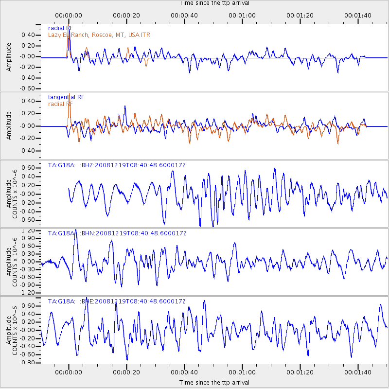
G18A Lazy EL Ranch, Roscoe, MT, USA - Earthquake Result Viewer
*The percent match for this event was below the threshold and hence no stack was calculated.
| Earthquake location: |
Northern Mid-Atlantic Ridge |
| Earthquake latitude/longitude: |
47.0/-27.3 |
| Earthquake time(UTC): |
2008/12/19 (354) 08:31:51 GMT |
| Earthquake Depth: |
2.0 km |
| Earthquake Magnitude: |
5.8 MB, 5.6 MS, 5.9 MW, 5.8 MW |
| Earthquake Catalog/Contributor: |
WHDF/NEIC |
|
| Network: |
TA USArray Transportable Network (new EarthScope stations) |
| Station: |
G18A Lazy EL Ranch, Roscoe, MT, USA |
| Lat/Lon: |
45.32 N/109.56 W |
| Elevation: |
1699 m |
|
| Distance: |
54.4 deg |
| Az: |
300.744 deg |
| Baz: |
56.482 deg |
| Ray Param: |
$rayparam |
*The percent match for this event was below the threshold and hence was not used in the summary stack. |
|
| Radial Match: |
59.163826 % |
| Radial Bump: |
400 |
| Transverse Match: |
63.708454 % |
| Transverse Bump: |
400 |
| SOD ConfigId: |
2658 |
| Insert Time: |
2010-03-06 13:35:57.714 +0000 |
| GWidth: |
2.5 |
| Max Bumps: |
400 |
| Tol: |
0.001 |
|
Signal To Noise
| Channel | StoN | STA | LTA |
| TA:G18A: :BHN:20081219T08:40:48.600017Z | 5.1611495 | 5.651685E-7 | 1.09504384E-7 |
| TA:G18A: :BHE:20081219T08:40:48.600017Z | 1.61303 | 2.9542974E-7 | 1.8315204E-7 |
| TA:G18A: :BHZ:20081219T08:40:48.600017Z | 1.6006297 | 2.9862687E-7 | 1.8656837E-7 |
| Arrivals |
| Ps | |
| PpPs | |
| PsPs/PpSs | |


