You are here: Home > Network List > TA - USArray Transportable Network (new EarthScope stations) Stations List
> Station C16K Lisburne Hills, AK, USA > Earthquake Result Viewer
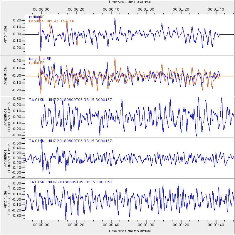
C16K Lisburne Hills, AK, USA - Earthquake Result Viewer
*The percent match for this event was below the threshold and hence no stack was calculated.
| Earthquake location: |
Sumbawa Region, Indonesia |
| Earthquake latitude/longitude: |
-8.4/116.2 |
| Earthquake time(UTC): |
2018/08/09 (221) 05:25:31 GMT |
| Earthquake Depth: |
10 km |
| Earthquake Magnitude: |
5.9 Mww |
| Earthquake Catalog/Contributor: |
NEIC PDE/us |
|
| Network: |
TA USArray Transportable Network (new EarthScope stations) |
| Station: |
C16K Lisburne Hills, AK, USA |
| Lat/Lon: |
68.27 N/165.34 W |
| Elevation: |
102 m |
|
| Distance: |
93.5 deg |
| Az: |
21.435 deg |
| Baz: |
256.213 deg |
| Ray Param: |
$rayparam |
*The percent match for this event was below the threshold and hence was not used in the summary stack. |
|
| Radial Match: |
64.041855 % |
| Radial Bump: |
400 |
| Transverse Match: |
51.466766 % |
| Transverse Bump: |
379 |
| SOD ConfigId: |
13570011 |
| Insert Time: |
2019-04-30 18:11:33.952 +0000 |
| GWidth: |
2.5 |
| Max Bumps: |
400 |
| Tol: |
0.001 |
|
Signal To Noise
| Channel | StoN | STA | LTA |
| TA:C16K: :BHZ:20180809T05:38:15.300015Z | 3.1328928 | 3.5783663E-7 | 1.1421924E-7 |
| TA:C16K: :BHN:20180809T05:38:15.300015Z | 0.9536885 | 9.966624E-8 | 1.04506064E-7 |
| TA:C16K: :BHE:20180809T05:38:15.300015Z | 0.809467 | 1.0313156E-7 | 1.2740675E-7 |
| Arrivals |
| Ps | |
| PpPs | |
| PsPs/PpSs | |


