You are here: Home > Network List > TA - USArray Transportable Network (new EarthScope stations) Stations List
> Station G21K Allakaket, AK, USA > Earthquake Result Viewer
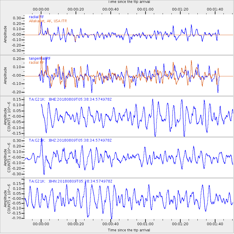
G21K Allakaket, AK, USA - Earthquake Result Viewer
*The percent match for this event was below the threshold and hence no stack was calculated.
| Earthquake location: |
Sumbawa Region, Indonesia |
| Earthquake latitude/longitude: |
-8.4/116.2 |
| Earthquake time(UTC): |
2018/08/09 (221) 05:25:31 GMT |
| Earthquake Depth: |
10 km |
| Earthquake Magnitude: |
5.9 Mww |
| Earthquake Catalog/Contributor: |
NEIC PDE/us |
|
| Network: |
TA USArray Transportable Network (new EarthScope stations) |
| Station: |
G21K Allakaket, AK, USA |
| Lat/Lon: |
66.52 N/153.51 W |
| Elevation: |
446 m |
|
| Distance: |
97.7 deg |
| Az: |
23.856 deg |
| Baz: |
266.9 deg |
| Ray Param: |
$rayparam |
*The percent match for this event was below the threshold and hence was not used in the summary stack. |
|
| Radial Match: |
46.905617 % |
| Radial Bump: |
372 |
| Transverse Match: |
52.291134 % |
| Transverse Bump: |
384 |
| SOD ConfigId: |
13570011 |
| Insert Time: |
2019-04-30 18:11:49.166 +0000 |
| GWidth: |
2.5 |
| Max Bumps: |
400 |
| Tol: |
0.001 |
|
Signal To Noise
| Channel | StoN | STA | LTA |
| TA:G21K: :BHZ:20180809T05:38:34.574978Z | 2.5594604 | 1.5548459E-7 | 6.0748974E-8 |
| TA:G21K: :BHN:20180809T05:38:34.574978Z | 0.8972445 | 4.7708447E-8 | 5.317218E-8 |
| TA:G21K: :BHE:20180809T05:38:34.574978Z | 0.7816941 | 3.8657035E-8 | 4.9452893E-8 |
| Arrivals |
| Ps | |
| PpPs | |
| PsPs/PpSs | |


