You are here: Home > Network List > TA - USArray Transportable Network (new EarthScope stations) Stations List
> Station G18A Lazy EL Ranch, Roscoe, MT, USA > Earthquake Result Viewer
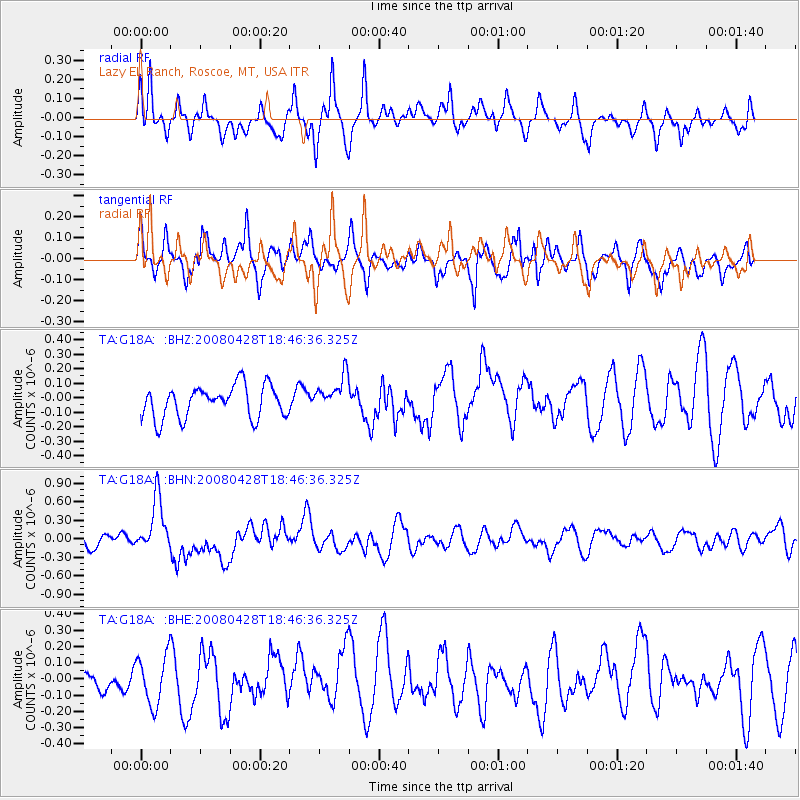
G18A Lazy EL Ranch, Roscoe, MT, USA - Earthquake Result Viewer
*The percent match for this event was below the threshold and hence no stack was calculated.
| Earthquake location: |
Vanuatu Islands |
| Earthquake latitude/longitude: |
-19.9/169.0 |
| Earthquake time(UTC): |
2008/04/28 (119) 18:33:34 GMT |
| Earthquake Depth: |
32 km |
| Earthquake Magnitude: |
6.2 MB, 6.2 MS, 6.4 MW, 6.4 MW |
| Earthquake Catalog/Contributor: |
WHDF/NEIC |
|
| Network: |
TA USArray Transportable Network (new EarthScope stations) |
| Station: |
G18A Lazy EL Ranch, Roscoe, MT, USA |
| Lat/Lon: |
45.32 N/109.56 W |
| Elevation: |
1699 m |
|
| Distance: |
98.2 deg |
| Az: |
44.824 deg |
| Baz: |
250.038 deg |
| Ray Param: |
$rayparam |
*The percent match for this event was below the threshold and hence was not used in the summary stack. |
|
| Radial Match: |
66.254364 % |
| Radial Bump: |
400 |
| Transverse Match: |
68.22252 % |
| Transverse Bump: |
400 |
| SOD ConfigId: |
2504 |
| Insert Time: |
2010-03-06 13:36:30.644 +0000 |
| GWidth: |
2.5 |
| Max Bumps: |
400 |
| Tol: |
0.001 |
|
Signal To Noise
| Channel | StoN | STA | LTA |
| TA:G18A: :BHN:20080428T18:46:36.325Z | 3.5436335 | 4.3621696E-7 | 1.2309879E-7 |
| TA:G18A: :BHE:20080428T18:46:36.325Z | 1.9602268 | 1.5355342E-7 | 7.8334516E-8 |
| TA:G18A: :BHZ:20080428T18:46:36.325Z | 1.1240779 | 1.2413854E-7 | 1.10435884E-7 |
| Arrivals |
| Ps | |
| PpPs | |
| PsPs/PpSs | |


