You are here: Home > Network List > AZ - ANZA Regional Network Stations List
> Station FRD AZ.FRD > Earthquake Result Viewer
FRD AZ.FRD - Earthquake Result Viewer
*The percent match for this event was below the threshold and hence no stack was calculated.
| Earthquake location: |
Near Coast Of Guatemala |
| Earthquake latitude/longitude: |
13.6/-91.2 |
| Earthquake time(UTC): |
2018/08/09 (221) 19:21:53 GMT |
| Earthquake Depth: |
29 km |
| Earthquake Magnitude: |
5.6 Mww |
| Earthquake Catalog/Contributor: |
NEIC PDE/us |
|
| Network: |
AZ ANZA Regional Network |
| Station: |
FRD AZ.FRD |
| Lat/Lon: |
33.49 N/116.60 W |
| Elevation: |
1164 m |
|
| Distance: |
30.5 deg |
| Az: |
314.957 deg |
| Baz: |
124.564 deg |
| Ray Param: |
$rayparam |
*The percent match for this event was below the threshold and hence was not used in the summary stack. |
|
| Radial Match: |
39.773834 % |
| Radial Bump: |
400 |
| Transverse Match: |
43.34486 % |
| Transverse Bump: |
400 |
| SOD ConfigId: |
13570011 |
| Insert Time: |
2019-04-30 18:17:37.108 +0000 |
| GWidth: |
2.5 |
| Max Bumps: |
400 |
| Tol: |
0.001 |
|
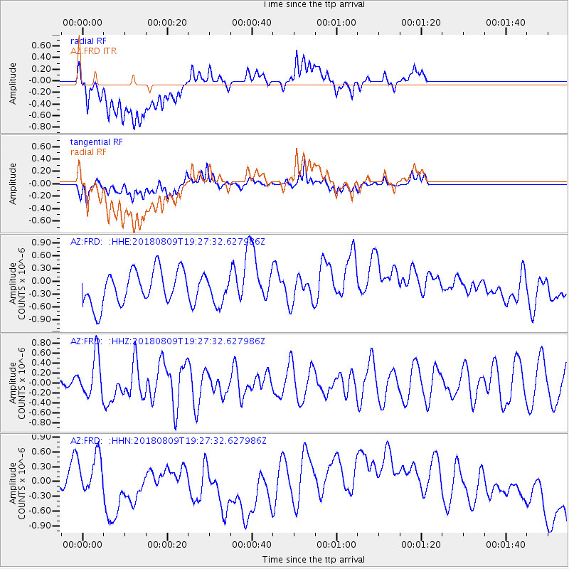
Signal To Noise
| Channel | StoN | STA | LTA |
| AZ:FRD: :HHZ:20180809T19:27:32.627986Z | 1.2336394 | 4.2584793E-7 | 3.4519647E-7 |
| AZ:FRD: :HHN:20180809T19:27:32.627986Z | 0.9559373 | 3.4237257E-7 | 3.5815378E-7 |
| AZ:FRD: :HHE:20180809T19:27:32.627986Z | 0.9240681 | 3.646481E-7 | 3.946117E-7 |
| Arrivals |
| Ps | |
| PpPs | |
| PsPs/PpSs | |


