You are here: Home > Network List > TA - USArray Transportable Network (new EarthScope stations) Stations List
> Station G18A Lazy EL Ranch, Roscoe, MT, USA > Earthquake Result Viewer
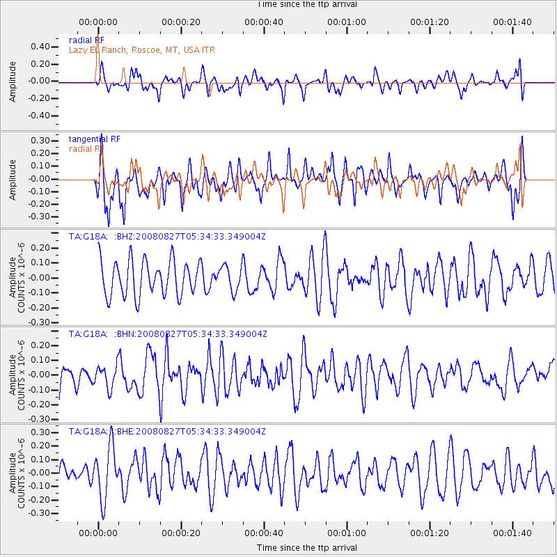
G18A Lazy EL Ranch, Roscoe, MT, USA - Earthquake Result Viewer
*The percent match for this event was below the threshold and hence no stack was calculated.
| Earthquake location: |
Kuril Islands |
| Earthquake latitude/longitude: |
46.7/152.5 |
| Earthquake time(UTC): |
2008/08/27 (240) 05:24:41 GMT |
| Earthquake Depth: |
65 km |
| Earthquake Magnitude: |
5.5 MB, 5.4 MW, 5.3 MW |
| Earthquake Catalog/Contributor: |
WHDF/NEIC |
|
| Network: |
TA USArray Transportable Network (new EarthScope stations) |
| Station: |
G18A Lazy EL Ranch, Roscoe, MT, USA |
| Lat/Lon: |
45.32 N/109.56 W |
| Elevation: |
1699 m |
|
| Distance: |
63.4 deg |
| Az: |
51.374 deg |
| Baz: |
310.384 deg |
| Ray Param: |
$rayparam |
*The percent match for this event was below the threshold and hence was not used in the summary stack. |
|
| Radial Match: |
46.567944 % |
| Radial Bump: |
400 |
| Transverse Match: |
58.540348 % |
| Transverse Bump: |
400 |
| SOD ConfigId: |
2504 |
| Insert Time: |
2010-03-06 13:37:08.895 +0000 |
| GWidth: |
2.5 |
| Max Bumps: |
400 |
| Tol: |
0.001 |
|
Signal To Noise
| Channel | StoN | STA | LTA |
| TA:G18A: :BHN:20080827T05:34:33.349004Z | 0.84848887 | 7.752503E-8 | 9.136835E-8 |
| TA:G18A: :BHE:20080827T05:34:33.349004Z | 2.253633 | 2.0056784E-7 | 8.899756E-8 |
| TA:G18A: :BHZ:20080827T05:34:33.349004Z | 0.7376208 | 8.592356E-8 | 1.1648745E-7 |
| Arrivals |
| Ps | |
| PpPs | |
| PsPs/PpSs | |


