You are here: Home > Network List > TA - USArray Transportable Network (new EarthScope stations) Stations List
> Station E18K Tukpahlearik Creek, AK, USA > Earthquake Result Viewer
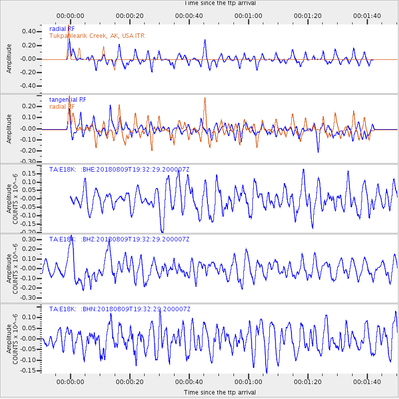
E18K Tukpahlearik Creek, AK, USA - Earthquake Result Viewer
*The percent match for this event was below the threshold and hence no stack was calculated.
| Earthquake location: |
Near Coast Of Guatemala |
| Earthquake latitude/longitude: |
13.6/-91.2 |
| Earthquake time(UTC): |
2018/08/09 (221) 19:21:53 GMT |
| Earthquake Depth: |
29 km |
| Earthquake Magnitude: |
5.6 Mww |
| Earthquake Catalog/Contributor: |
NEIC PDE/us |
|
| Network: |
TA USArray Transportable Network (new EarthScope stations) |
| Station: |
E18K Tukpahlearik Creek, AK, USA |
| Lat/Lon: |
67.42 N/160.60 W |
| Elevation: |
297 m |
|
| Distance: |
69.7 deg |
| Az: |
337.327 deg |
| Baz: |
103.896 deg |
| Ray Param: |
$rayparam |
*The percent match for this event was below the threshold and hence was not used in the summary stack. |
|
| Radial Match: |
64.84171 % |
| Radial Bump: |
302 |
| Transverse Match: |
57.83575 % |
| Transverse Bump: |
400 |
| SOD ConfigId: |
13570011 |
| Insert Time: |
2019-04-30 18:21:58.891 +0000 |
| GWidth: |
2.5 |
| Max Bumps: |
400 |
| Tol: |
0.001 |
|
Signal To Noise
| Channel | StoN | STA | LTA |
| TA:E18K: :BHZ:20180809T19:32:29.200007Z | 2.9206872 | 1.9169819E-7 | 6.5634616E-8 |
| TA:E18K: :BHN:20180809T19:32:29.200007Z | 1.4700294 | 4.445192E-8 | 3.0238798E-8 |
| TA:E18K: :BHE:20180809T19:32:29.200007Z | 2.2978103 | 1.0786509E-7 | 4.6942557E-8 |
| Arrivals |
| Ps | |
| PpPs | |
| PsPs/PpSs | |


