You are here: Home > Network List > TA - USArray Transportable Network (new EarthScope stations) Stations List
> Station F20K Avaraart Lake, AK, USA > Earthquake Result Viewer
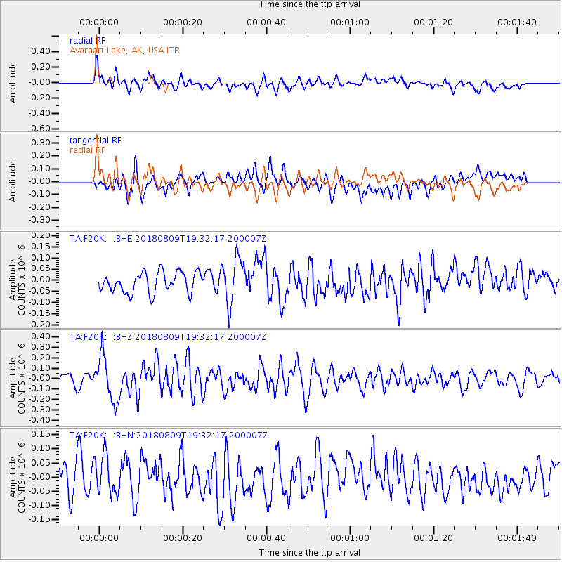
F20K Avaraart Lake, AK, USA - Earthquake Result Viewer
*The percent match for this event was below the threshold and hence no stack was calculated.
| Earthquake location: |
Near Coast Of Guatemala |
| Earthquake latitude/longitude: |
13.6/-91.2 |
| Earthquake time(UTC): |
2018/08/09 (221) 19:21:53 GMT |
| Earthquake Depth: |
29 km |
| Earthquake Magnitude: |
5.6 Mww |
| Earthquake Catalog/Contributor: |
NEIC PDE/us |
|
| Network: |
TA USArray Transportable Network (new EarthScope stations) |
| Station: |
F20K Avaraart Lake, AK, USA |
| Lat/Lon: |
67.05 N/155.73 W |
| Elevation: |
136 m |
|
| Distance: |
67.8 deg |
| Az: |
337.508 deg |
| Baz: |
108.456 deg |
| Ray Param: |
$rayparam |
*The percent match for this event was below the threshold and hence was not used in the summary stack. |
|
| Radial Match: |
61.470215 % |
| Radial Bump: |
400 |
| Transverse Match: |
50.42397 % |
| Transverse Bump: |
400 |
| SOD ConfigId: |
13570011 |
| Insert Time: |
2019-04-30 18:22:09.364 +0000 |
| GWidth: |
2.5 |
| Max Bumps: |
400 |
| Tol: |
0.001 |
|
Signal To Noise
| Channel | StoN | STA | LTA |
| TA:F20K: :BHZ:20180809T19:32:17.200007Z | 4.341783 | 2.2030366E-7 | 5.0740365E-8 |
| TA:F20K: :BHN:20180809T19:32:17.200007Z | 1.4455671 | 6.7409914E-8 | 4.6632156E-8 |
| TA:F20K: :BHE:20180809T19:32:17.200007Z | 2.2622807 | 1.02741666E-7 | 4.541508E-8 |
| Arrivals |
| Ps | |
| PpPs | |
| PsPs/PpSs | |


