You are here: Home > Network List > TA - USArray Transportable Network (new EarthScope stations) Stations List
> Station G21K Allakaket, AK, USA > Earthquake Result Viewer
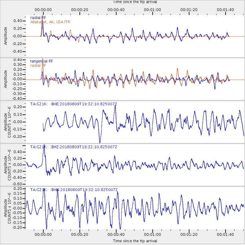
G21K Allakaket, AK, USA - Earthquake Result Viewer
*The percent match for this event was below the threshold and hence no stack was calculated.
| Earthquake location: |
Near Coast Of Guatemala |
| Earthquake latitude/longitude: |
13.6/-91.2 |
| Earthquake time(UTC): |
2018/08/09 (221) 19:21:53 GMT |
| Earthquake Depth: |
29 km |
| Earthquake Magnitude: |
5.6 Mww |
| Earthquake Catalog/Contributor: |
NEIC PDE/us |
|
| Network: |
TA USArray Transportable Network (new EarthScope stations) |
| Station: |
G21K Allakaket, AK, USA |
| Lat/Lon: |
66.52 N/153.51 W |
| Elevation: |
446 m |
|
| Distance: |
66.8 deg |
| Az: |
337.278 deg |
| Baz: |
110.404 deg |
| Ray Param: |
$rayparam |
*The percent match for this event was below the threshold and hence was not used in the summary stack. |
|
| Radial Match: |
70.7313 % |
| Radial Bump: |
349 |
| Transverse Match: |
67.99448 % |
| Transverse Bump: |
380 |
| SOD ConfigId: |
13570011 |
| Insert Time: |
2019-04-30 18:22:23.558 +0000 |
| GWidth: |
2.5 |
| Max Bumps: |
400 |
| Tol: |
0.001 |
|
Signal To Noise
| Channel | StoN | STA | LTA |
| TA:G21K: :BHZ:20180809T19:32:10.825007Z | 3.6315732 | 2.807414E-7 | 7.730573E-8 |
| TA:G21K: :BHN:20180809T19:32:10.825007Z | 1.8002023 | 1.04931914E-7 | 5.8288958E-8 |
| TA:G21K: :BHE:20180809T19:32:10.825007Z | 2.3748152 | 1.3369171E-7 | 5.629563E-8 |
| Arrivals |
| Ps | |
| PpPs | |
| PsPs/PpSs | |


