You are here: Home > Network List > TA - USArray Transportable Network (new EarthScope stations) Stations List
> Station G31M Satah River, YT, CAN > Earthquake Result Viewer
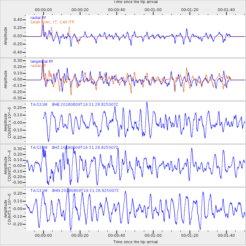
G31M Satah River, YT, CAN - Earthquake Result Viewer
*The percent match for this event was below the threshold and hence no stack was calculated.
| Earthquake location: |
Near Coast Of Guatemala |
| Earthquake latitude/longitude: |
13.6/-91.2 |
| Earthquake time(UTC): |
2018/08/09 (221) 19:21:53 GMT |
| Earthquake Depth: |
29 km |
| Earthquake Magnitude: |
5.6 Mww |
| Earthquake Catalog/Contributor: |
NEIC PDE/us |
|
| Network: |
TA USArray Transportable Network (new EarthScope stations) |
| Station: |
G31M Satah River, YT, CAN |
| Lat/Lon: |
66.92 N/134.27 W |
| Elevation: |
61 m |
|
| Distance: |
60.4 deg |
| Az: |
341.954 deg |
| Baz: |
130.166 deg |
| Ray Param: |
$rayparam |
*The percent match for this event was below the threshold and hence was not used in the summary stack. |
|
| Radial Match: |
58.26102 % |
| Radial Bump: |
311 |
| Transverse Match: |
65.12685 % |
| Transverse Bump: |
400 |
| SOD ConfigId: |
13570011 |
| Insert Time: |
2019-04-30 18:22:27.980 +0000 |
| GWidth: |
2.5 |
| Max Bumps: |
400 |
| Tol: |
0.001 |
|
Signal To Noise
| Channel | StoN | STA | LTA |
| TA:G31M: :BHZ:20180809T19:31:28.825007Z | 3.817963 | 2.1887422E-7 | 5.7327487E-8 |
| TA:G31M: :BHN:20180809T19:31:28.825007Z | 1.7511493 | 1.2577426E-7 | 7.1823834E-8 |
| TA:G31M: :BHE:20180809T19:31:28.825007Z | 1.2957627 | 1.1544532E-7 | 8.909449E-8 |
| Arrivals |
| Ps | |
| PpPs | |
| PsPs/PpSs | |


