You are here: Home > Network List > TA - USArray Transportable Network (new EarthScope stations) Stations List
> Station K15K Wolf Creek Mountain, AK, USA > Earthquake Result Viewer
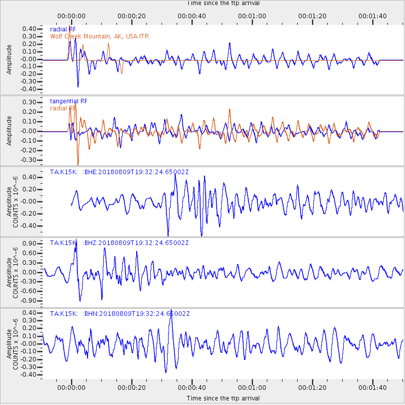
K15K Wolf Creek Mountain, AK, USA - Earthquake Result Viewer
*The percent match for this event was below the threshold and hence no stack was calculated.
| Earthquake location: |
Near Coast Of Guatemala |
| Earthquake latitude/longitude: |
13.6/-91.2 |
| Earthquake time(UTC): |
2018/08/09 (221) 19:21:53 GMT |
| Earthquake Depth: |
29 km |
| Earthquake Magnitude: |
5.6 Mww |
| Earthquake Catalog/Contributor: |
NEIC PDE/us |
|
| Network: |
TA USArray Transportable Network (new EarthScope stations) |
| Station: |
K15K Wolf Creek Mountain, AK, USA |
| Lat/Lon: |
62.29 N/161.53 W |
| Elevation: |
346 m |
|
| Distance: |
69.0 deg |
| Az: |
331.862 deg |
| Baz: |
101.126 deg |
| Ray Param: |
$rayparam |
*The percent match for this event was below the threshold and hence was not used in the summary stack. |
|
| Radial Match: |
62.894127 % |
| Radial Bump: |
388 |
| Transverse Match: |
50.910633 % |
| Transverse Bump: |
388 |
| SOD ConfigId: |
13570011 |
| Insert Time: |
2019-04-30 18:22:51.844 +0000 |
| GWidth: |
2.5 |
| Max Bumps: |
400 |
| Tol: |
0.001 |
|
Signal To Noise
| Channel | StoN | STA | LTA |
| TA:K15K: :BHZ:20180809T19:32:24.65002Z | 6.7587 | 4.829535E-7 | 7.1456576E-8 |
| TA:K15K: :BHN:20180809T19:32:24.65002Z | 1.3613806 | 1.0180995E-7 | 7.478434E-8 |
| TA:K15K: :BHE:20180809T19:32:24.65002Z | 2.9122756 | 2.296575E-7 | 7.8858434E-8 |
| Arrivals |
| Ps | |
| PpPs | |
| PsPs/PpSs | |


