You are here: Home > Network List > TA - USArray Transportable Network (new EarthScope stations) Stations List
> Station MDND Maddock, ND, USA > Earthquake Result Viewer
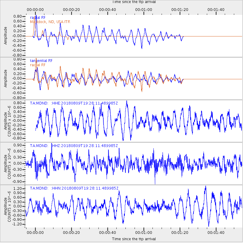
MDND Maddock, ND, USA - Earthquake Result Viewer
*The percent match for this event was below the threshold and hence no stack was calculated.
| Earthquake location: |
Near Coast Of Guatemala |
| Earthquake latitude/longitude: |
13.6/-91.2 |
| Earthquake time(UTC): |
2018/08/09 (221) 19:21:53 GMT |
| Earthquake Depth: |
29 km |
| Earthquake Magnitude: |
5.6 Mww |
| Earthquake Catalog/Contributor: |
NEIC PDE/us |
|
| Network: |
TA USArray Transportable Network (new EarthScope stations) |
| Station: |
MDND Maddock, ND, USA |
| Lat/Lon: |
47.85 N/99.60 W |
| Elevation: |
479 m |
|
| Distance: |
34.9 deg |
| Az: |
350.067 deg |
| Baz: |
165.579 deg |
| Ray Param: |
$rayparam |
*The percent match for this event was below the threshold and hence was not used in the summary stack. |
|
| Radial Match: |
72.25558 % |
| Radial Bump: |
298 |
| Transverse Match: |
57.994804 % |
| Transverse Bump: |
327 |
| SOD ConfigId: |
13570011 |
| Insert Time: |
2019-04-30 18:23:16.320 +0000 |
| GWidth: |
2.5 |
| Max Bumps: |
400 |
| Tol: |
0.001 |
|
Signal To Noise
| Channel | StoN | STA | LTA |
| TA:MDND: :HHZ:20180809T19:28:11.489985Z | 2.3353248 | 3.3669275E-7 | 1.4417384E-7 |
| TA:MDND: :HHN:20180809T19:28:11.489985Z | 0.6342075 | 2.6756535E-7 | 4.2188933E-7 |
| TA:MDND: :HHE:20180809T19:28:11.489985Z | 1.2014974 | 4.2244142E-7 | 3.515958E-7 |
| Arrivals |
| Ps | |
| PpPs | |
| PsPs/PpSs | |


