You are here: Home > Network List > TA - USArray Transportable Network (new EarthScope stations) Stations List
> Station R33M Jennings River, BC, CAN > Earthquake Result Viewer
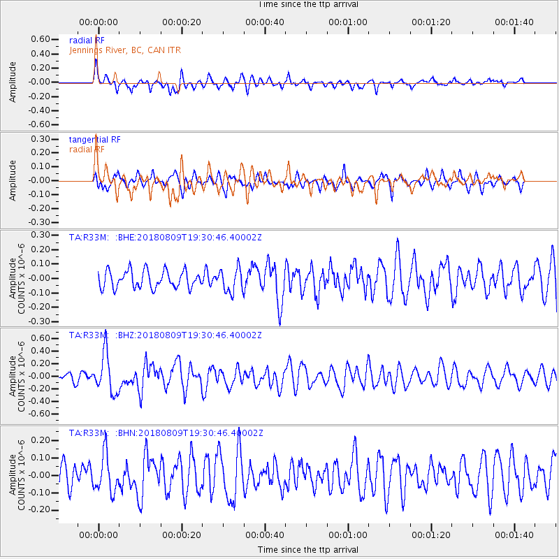
R33M Jennings River, BC, CAN - Earthquake Result Viewer
*The percent match for this event was below the threshold and hence no stack was calculated.
| Earthquake location: |
Near Coast Of Guatemala |
| Earthquake latitude/longitude: |
13.6/-91.2 |
| Earthquake time(UTC): |
2018/08/09 (221) 19:21:53 GMT |
| Earthquake Depth: |
29 km |
| Earthquake Magnitude: |
5.6 Mww |
| Earthquake Catalog/Contributor: |
NEIC PDE/us |
|
| Network: |
TA USArray Transportable Network (new EarthScope stations) |
| Station: |
R33M Jennings River, BC, CAN |
| Lat/Lon: |
59.39 N/130.97 W |
| Elevation: |
1437 m |
|
| Distance: |
54.4 deg |
| Az: |
336.241 deg |
| Baz: |
130.03 deg |
| Ray Param: |
$rayparam |
*The percent match for this event was below the threshold and hence was not used in the summary stack. |
|
| Radial Match: |
67.90959 % |
| Radial Bump: |
394 |
| Transverse Match: |
52.114796 % |
| Transverse Bump: |
389 |
| SOD ConfigId: |
13570011 |
| Insert Time: |
2019-04-30 18:23:41.065 +0000 |
| GWidth: |
2.5 |
| Max Bumps: |
400 |
| Tol: |
0.001 |
|
Signal To Noise
| Channel | StoN | STA | LTA |
| TA:R33M: :BHZ:20180809T19:30:46.40002Z | 4.631277 | 3.2272135E-7 | 6.968302E-8 |
| TA:R33M: :BHN:20180809T19:30:46.40002Z | 1.4441202 | 1.0879108E-7 | 7.5333816E-8 |
| TA:R33M: :BHE:20180809T19:30:46.40002Z | 1.4686005 | 8.7673925E-8 | 5.969896E-8 |
| Arrivals |
| Ps | |
| PpPs | |
| PsPs/PpSs | |


