You are here: Home > Network List > UW - Pacific Northwest Regional Seismic Network Stations List
> Station LEBA Lebam, WA, USA > Earthquake Result Viewer
LEBA Lebam, WA, USA - Earthquake Result Viewer
*The percent match for this event was below the threshold and hence no stack was calculated.
| Earthquake location: |
Near Coast Of Guatemala |
| Earthquake latitude/longitude: |
13.6/-91.2 |
| Earthquake time(UTC): |
2018/08/09 (221) 19:21:53 GMT |
| Earthquake Depth: |
29 km |
| Earthquake Magnitude: |
5.6 Mww |
| Earthquake Catalog/Contributor: |
NEIC PDE/us |
|
| Network: |
UW Pacific Northwest Regional Seismic Network |
| Station: |
LEBA Lebam, WA, USA |
| Lat/Lon: |
46.55 N/123.56 W |
| Elevation: |
73 m |
|
| Distance: |
42.6 deg |
| Az: |
326.933 deg |
| Baz: |
129.76 deg |
| Ray Param: |
$rayparam |
*The percent match for this event was below the threshold and hence was not used in the summary stack. |
|
| Radial Match: |
70.77943 % |
| Radial Bump: |
400 |
| Transverse Match: |
65.16295 % |
| Transverse Bump: |
399 |
| SOD ConfigId: |
13570011 |
| Insert Time: |
2019-04-30 18:24:48.373 +0000 |
| GWidth: |
2.5 |
| Max Bumps: |
400 |
| Tol: |
0.001 |
|
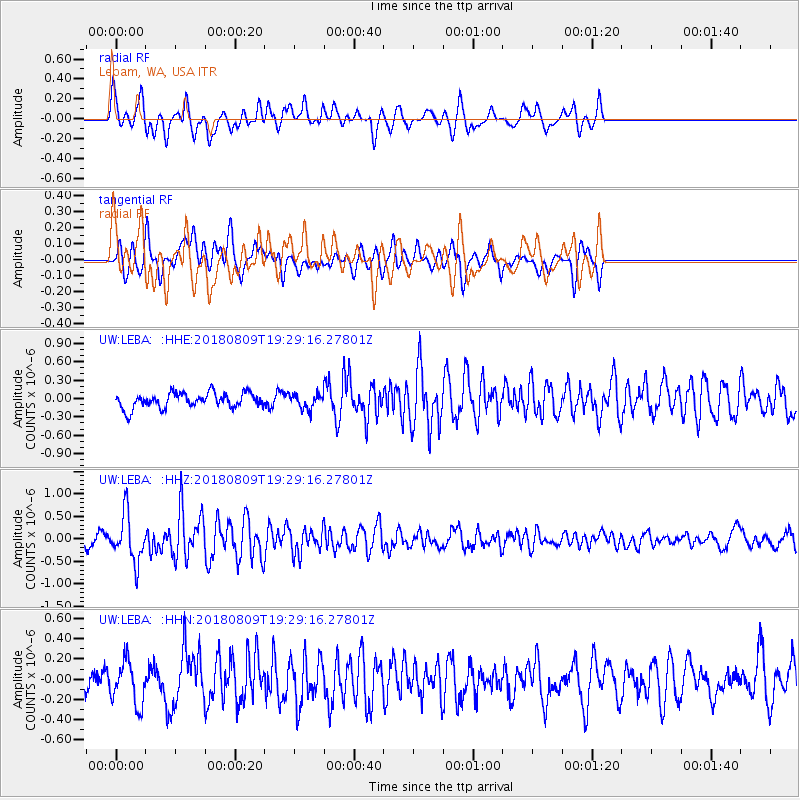
Signal To Noise
| Channel | StoN | STA | LTA |
| UW:LEBA: :HHZ:20180809T19:29:16.27801Z | 6.554884 | 5.2089376E-7 | 7.946651E-8 |
| UW:LEBA: :HHN:20180809T19:29:16.27801Z | 1.8472562 | 2.1196287E-7 | 1.1474471E-7 |
| UW:LEBA: :HHE:20180809T19:29:16.27801Z | 1.3140434 | 1.6200394E-7 | 1.232866E-7 |
| Arrivals |
| Ps | |
| PpPs | |
| PsPs/PpSs | |


