You are here: Home > Network List > UW - Pacific Northwest Regional Seismic Network Stations List
> Station UMAT Pilot Rock, OR, USA > Earthquake Result Viewer
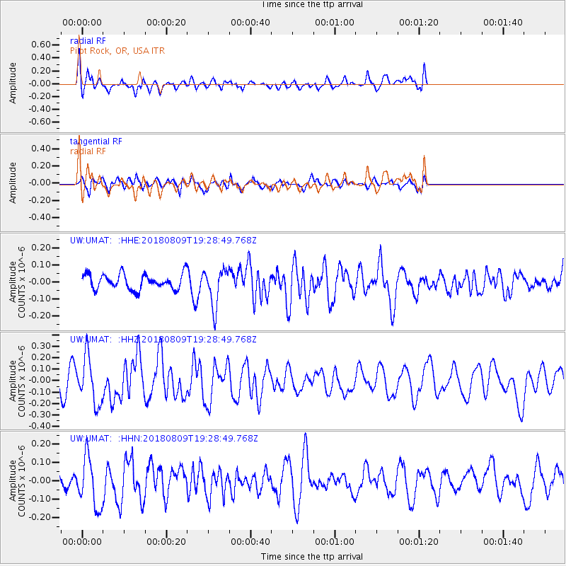
UMAT Pilot Rock, OR, USA - Earthquake Result Viewer
*The percent match for this event was below the threshold and hence no stack was calculated.
| Earthquake location: |
Near Coast Of Guatemala |
| Earthquake latitude/longitude: |
13.6/-91.2 |
| Earthquake time(UTC): |
2018/08/09 (221) 19:21:53 GMT |
| Earthquake Depth: |
29 km |
| Earthquake Magnitude: |
5.6 Mww |
| Earthquake Catalog/Contributor: |
NEIC PDE/us |
|
| Network: |
UW Pacific Northwest Regional Seismic Network |
| Station: |
UMAT Pilot Rock, OR, USA |
| Lat/Lon: |
45.29 N/118.96 W |
| Elevation: |
1318 m |
|
| Distance: |
39.4 deg |
| Az: |
328.797 deg |
| Baz: |
134.464 deg |
| Ray Param: |
$rayparam |
*The percent match for this event was below the threshold and hence was not used in the summary stack. |
|
| Radial Match: |
65.30441 % |
| Radial Bump: |
400 |
| Transverse Match: |
65.58528 % |
| Transverse Bump: |
400 |
| SOD ConfigId: |
13570011 |
| Insert Time: |
2019-04-30 18:24:59.460 +0000 |
| GWidth: |
2.5 |
| Max Bumps: |
400 |
| Tol: |
0.001 |
|
Signal To Noise
| Channel | StoN | STA | LTA |
| UW:UMAT: :HHZ:20180809T19:28:49.768Z | 2.14461 | 2.0906315E-7 | 9.748307E-8 |
| UW:UMAT: :HHN:20180809T19:28:49.768Z | 2.0733573 | 1.4128814E-7 | 6.8144615E-8 |
| UW:UMAT: :HHE:20180809T19:28:49.768Z | 2.4608924 | 1.1351594E-7 | 4.612796E-8 |
| Arrivals |
| Ps | |
| PpPs | |
| PsPs/PpSs | |


