You are here: Home > Network List > US - United States National Seismic Network Stations List
> Station MNTX Cornudas Mountains, Texas, USA > Earthquake Result Viewer
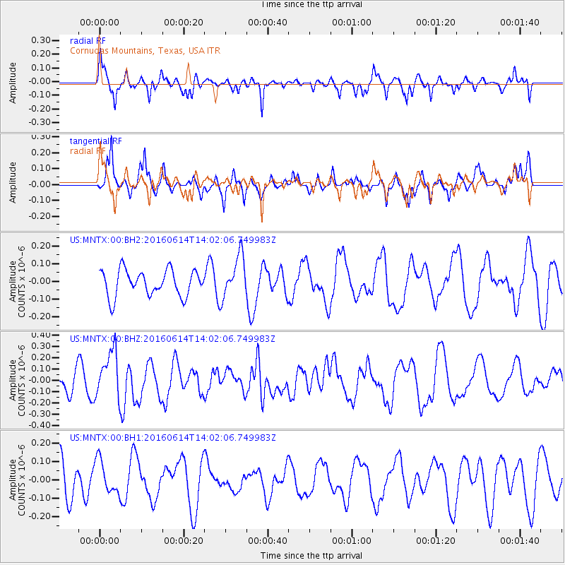
MNTX Cornudas Mountains, Texas, USA - Earthquake Result Viewer
*The percent match for this event was below the threshold and hence no stack was calculated.
| Earthquake location: |
Vanuatu Islands |
| Earthquake latitude/longitude: |
-18.8/168.8 |
| Earthquake time(UTC): |
2016/06/14 (166) 13:49:22 GMT |
| Earthquake Depth: |
111 km |
| Earthquake Magnitude: |
6.2 MWW, 6.2 MWB |
| Earthquake Catalog/Contributor: |
NEIC PDE/NEIC COMCAT |
|
| Network: |
US United States National Seismic Network |
| Station: |
MNTX Cornudas Mountains, Texas, USA |
| Lat/Lon: |
31.70 N/105.38 W |
| Elevation: |
404 m |
|
| Distance: |
96.2 deg |
| Az: |
58.772 deg |
| Baz: |
251.897 deg |
| Ray Param: |
$rayparam |
*The percent match for this event was below the threshold and hence was not used in the summary stack. |
|
| Radial Match: |
77.40543 % |
| Radial Bump: |
333 |
| Transverse Match: |
69.70956 % |
| Transverse Bump: |
302 |
| SOD ConfigId: |
1609551 |
| Insert Time: |
2016-06-28 13:52:12.779 +0000 |
| GWidth: |
2.5 |
| Max Bumps: |
400 |
| Tol: |
0.001 |
|
Signal To Noise
| Channel | StoN | STA | LTA |
| US:MNTX:00:BHZ:20160614T14:02:06.749983Z | 2.047749 | 2.1195422E-7 | 1.03505954E-7 |
| US:MNTX:00:BH1:20160614T14:02:06.749983Z | 1.0599546 | 9.309309E-8 | 8.782743E-8 |
| US:MNTX:00:BH2:20160614T14:02:06.749983Z | 1.6192517 | 1.1924632E-7 | 7.364286E-8 |
| Arrivals |
| Ps | |
| PpPs | |
| PsPs/PpSs | |


