You are here: Home > Network List > CI - Caltech Regional Seismic Network Stations List
> Station MPP McPhearson Peak > Earthquake Result Viewer
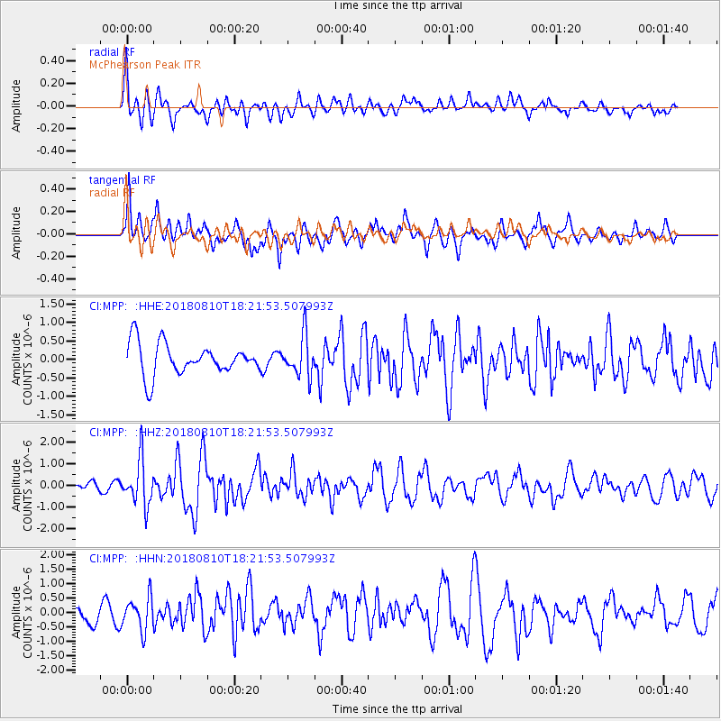
MPP McPhearson Peak - Earthquake Result Viewer
*The percent match for this event was below the threshold and hence no stack was calculated.
| Earthquake location: |
Kuril Islands |
| Earthquake latitude/longitude: |
48.5/154.8 |
| Earthquake time(UTC): |
2018/08/10 (222) 18:12:05 GMT |
| Earthquake Depth: |
16 km |
| Earthquake Magnitude: |
5.9 Mww |
| Earthquake Catalog/Contributor: |
NEIC PDE/us |
|
| Network: |
CI Caltech Regional Seismic Network |
| Station: |
MPP McPhearson Peak |
| Lat/Lon: |
34.89 N/119.81 W |
| Elevation: |
1739 m |
|
| Distance: |
62.0 deg |
| Az: |
68.072 deg |
| Baz: |
311.324 deg |
| Ray Param: |
$rayparam |
*The percent match for this event was below the threshold and hence was not used in the summary stack. |
|
| Radial Match: |
67.51697 % |
| Radial Bump: |
400 |
| Transverse Match: |
73.69256 % |
| Transverse Bump: |
400 |
| SOD ConfigId: |
13570011 |
| Insert Time: |
2019-04-30 18:31:28.747 +0000 |
| GWidth: |
2.5 |
| Max Bumps: |
400 |
| Tol: |
0.001 |
|
Signal To Noise
| Channel | StoN | STA | LTA |
| CI:MPP: :HHZ:20180810T18:21:53.507993Z | 5.027701 | 1.0739232E-6 | 2.1360124E-7 |
| CI:MPP: :HHN:20180810T18:21:53.507993Z | 2.5689254 | 5.694376E-7 | 2.2166373E-7 |
| CI:MPP: :HHE:20180810T18:21:53.507993Z | 1.2996982 | 5.565021E-7 | 4.2817788E-7 |
| Arrivals |
| Ps | |
| PpPs | |
| PsPs/PpSs | |


