You are here: Home > Network List > TA - USArray Transportable Network (new EarthScope stations) Stations List
> Station C11A Tepee Creek (NFS), Magee, ID, USA > Earthquake Result Viewer
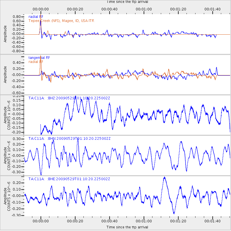
C11A Tepee Creek (NFS), Magee, ID, USA - Earthquake Result Viewer
*The percent match for this event was below the threshold and hence no stack was calculated.
| Earthquake location: |
Off Coast Of Jalisco, Mexico |
| Earthquake latitude/longitude: |
18.4/-106.5 |
| Earthquake time(UTC): |
2009/05/29 (149) 01:04:38 GMT |
| Earthquake Depth: |
11 km |
| Earthquake Magnitude: |
5.5 MW, 5.0 MS, 5.0 MB, 5.3 MW |
| Earthquake Catalog/Contributor: |
WHDF/NEIC |
|
| Network: |
TA USArray Transportable Network (new EarthScope stations) |
| Station: |
C11A Tepee Creek (NFS), Magee, ID, USA |
| Lat/Lon: |
47.84 N/116.26 W |
| Elevation: |
914 m |
|
| Distance: |
30.4 deg |
| Az: |
347.027 deg |
| Baz: |
161.552 deg |
| Ray Param: |
$rayparam |
*The percent match for this event was below the threshold and hence was not used in the summary stack. |
|
| Radial Match: |
53.194763 % |
| Radial Bump: |
400 |
| Transverse Match: |
44.438328 % |
| Transverse Bump: |
400 |
| SOD ConfigId: |
2648 |
| Insert Time: |
2010-03-06 13:40:56.310 +0000 |
| GWidth: |
2.5 |
| Max Bumps: |
400 |
| Tol: |
0.001 |
|
Signal To Noise
| Channel | StoN | STA | LTA |
| TA:C11A: :BHN:20090529T01:10:20.225002Z | 2.055396 | 1.8191385E-7 | 8.85055E-8 |
| TA:C11A: :BHE:20090529T01:10:20.225002Z | 1.7151557 | 7.603613E-8 | 4.433191E-8 |
| TA:C11A: :BHZ:20090529T01:10:20.225002Z | 0.76223564 | 9.2139494E-8 | 1.2088059E-7 |
| Arrivals |
| Ps | |
| PpPs | |
| PsPs/PpSs | |


