You are here: Home > Network List > TA - USArray Transportable Network (new EarthScope stations) Stations List
> Station C11A Tepee Creek (NFS), Magee, ID, USA > Earthquake Result Viewer
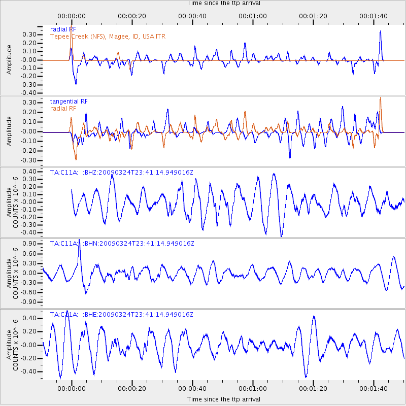
C11A Tepee Creek (NFS), Magee, ID, USA - Earthquake Result Viewer
*The percent match for this event was below the threshold and hence no stack was calculated.
| Earthquake location: |
New Britain Region, P.N.G. |
| Earthquake latitude/longitude: |
-5.1/151.8 |
| Earthquake time(UTC): |
2009/03/24 (083) 23:28:27 GMT |
| Earthquake Depth: |
36 km |
| Earthquake Magnitude: |
5.6 MB, 5.4 MS, 5.8 MW, 5.8 MW |
| Earthquake Catalog/Contributor: |
WHDF/NEIC |
|
| Network: |
TA USArray Transportable Network (new EarthScope stations) |
| Station: |
C11A Tepee Creek (NFS), Magee, ID, USA |
| Lat/Lon: |
47.84 N/116.26 W |
| Elevation: |
914 m |
|
| Distance: |
95.0 deg |
| Az: |
42.526 deg |
| Baz: |
267.956 deg |
| Ray Param: |
$rayparam |
*The percent match for this event was below the threshold and hence was not used in the summary stack. |
|
| Radial Match: |
52.09925 % |
| Radial Bump: |
400 |
| Transverse Match: |
63.277626 % |
| Transverse Bump: |
400 |
| SOD ConfigId: |
2658 |
| Insert Time: |
2010-03-06 13:41:15.080 +0000 |
| GWidth: |
2.5 |
| Max Bumps: |
400 |
| Tol: |
0.001 |
|
Signal To Noise
| Channel | StoN | STA | LTA |
| TA:C11A: :BHN:20090324T23:41:14.949016Z | 1.8827225 | 4.1021332E-7 | 2.1788304E-7 |
| TA:C11A: :BHE:20090324T23:41:14.949016Z | 1.7814062 | 2.642571E-7 | 1.4834185E-7 |
| TA:C11A: :BHZ:20090324T23:41:14.949016Z | 0.6799562 | 9.570285E-8 | 1.4074855E-7 |
| Arrivals |
| Ps | |
| PpPs | |
| PsPs/PpSs | |


