PHL Parkhill, California, USA - Earthquake Result Viewer
Earthquake location: Andreanof Islands, Aleutian Is.
Earthquake latitude/longitude: 51.4/-177.9
Earthquake time(UTC): 1997/10/15 (288) 03:11:09 GMT
Earthquake Depth: 22 km
Earthquake Magnitude: 5.7 MB, 6.1 MS, 6.3 UNKNOWN, 5.6 ML
Earthquake Catalog/Contributor: WHDF/NEIC
Network: CI Caltech Regional Seismic Network
Station: PHL Parkhill, California, USA
Lat/Lon: 35.41 N/120.55 W
Elevation: 351 m
Distance: 43.5 deg
Az: 88.562 deg
Baz: 309.993 deg
Ray Param: 0.07250415
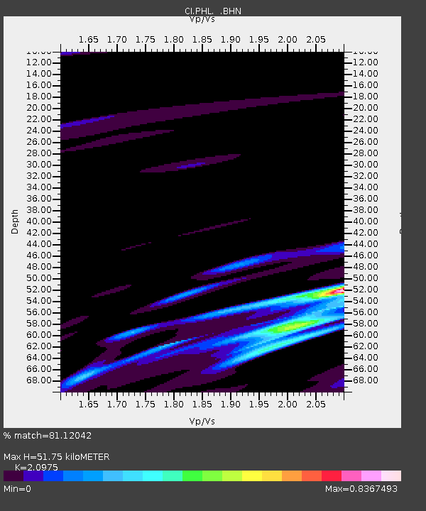
Estimated Moho Depth: 51.75 km
Estimated Crust Vp/Vs: 2.10
Assumed Crust Vp: 6.183 km/s
Estimated Crust Vs: 2.948 km/s
Estimated Crust Poisson's Ratio: 0.35
Radial Match: 81.12042 %
Radial Bump: 345
Transverse Match: 65.72934 %
Transverse Bump: 400
SOD ConfigId: 3787
Insert Time: 2010-02-26 02:10:50.193 +0000
GWidth: 2.5
Max Bumps: 400
Tol: 0.001

Signal To Noise

ChannelStoNSTALTA
CI:PHL: :BHN:19971015T03:18:39.614014Z1.09228474.811269E-74.4047758E-7
CI:PHL: :BHE:19971015T03:18:39.614014Z0.624755142.939369E-74.7048331E-7
CI:PHL: :BHZ:19971015T03:18:39.614014Z1.88144877.592128E-74.0352566E-7
Arrivals
Ps9.7 SECOND
PpPs25 SECOND
PsPs/PpSs34 SECOND