You are here: Home > Network List > TA - USArray Transportable Network (new EarthScope stations) Stations List
> Station C11A Tepee Creek (NFS), Magee, ID, USA > Earthquake Result Viewer
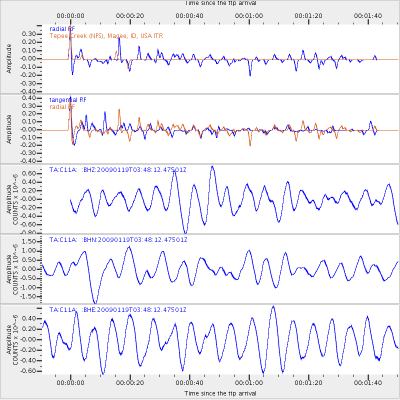
C11A Tepee Creek (NFS), Magee, ID, USA - Earthquake Result Viewer
*The percent match for this event was below the threshold and hence no stack was calculated.
| Earthquake location: |
Southeast Of Loyalty Islands |
| Earthquake latitude/longitude: |
-22.6/170.9 |
| Earthquake time(UTC): |
2009/01/19 (019) 03:35:18 GMT |
| Earthquake Depth: |
12 km |
| Earthquake Magnitude: |
5.7 MB, 6.4 MS, 6.5 MW, 6.5 MW |
| Earthquake Catalog/Contributor: |
WHDF/NEIC |
|
| Network: |
TA USArray Transportable Network (new EarthScope stations) |
| Station: |
C11A Tepee Creek (NFS), Magee, ID, USA |
| Lat/Lon: |
47.84 N/116.26 W |
| Elevation: |
914 m |
|
| Distance: |
95.7 deg |
| Az: |
40.302 deg |
| Baz: |
242.536 deg |
| Ray Param: |
$rayparam |
*The percent match for this event was below the threshold and hence was not used in the summary stack. |
|
| Radial Match: |
79.41393 % |
| Radial Bump: |
400 |
| Transverse Match: |
63.021988 % |
| Transverse Bump: |
319 |
| SOD ConfigId: |
2658 |
| Insert Time: |
2010-03-06 13:41:24.205 +0000 |
| GWidth: |
2.5 |
| Max Bumps: |
400 |
| Tol: |
0.001 |
|
Signal To Noise
| Channel | StoN | STA | LTA |
| TA:C11A: :BHN:20090119T03:48:12.47501Z | 1.3689039 | 5.8699675E-7 | 4.2880785E-7 |
| TA:C11A: :BHE:20090119T03:48:12.47501Z | 0.8325993 | 2.9600002E-7 | 3.5551318E-7 |
| TA:C11A: :BHZ:20090119T03:48:12.47501Z | 1.6678793 | 2.8433075E-7 | 1.7047442E-7 |
| Arrivals |
| Ps | |
| PpPs | |
| PsPs/PpSs | |


