You are here: Home > Network List > IW - Intermountain West Stations List
> Station MOOW Moose Ponds, Wyoming, USA > Earthquake Result Viewer
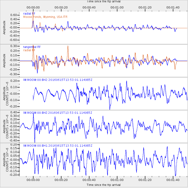
MOOW Moose Ponds, Wyoming, USA - Earthquake Result Viewer
*The percent match for this event was below the threshold and hence no stack was calculated.
| Earthquake location: |
Guatemala |
| Earthquake latitude/longitude: |
14.2/-91.5 |
| Earthquake time(UTC): |
2016/06/15 (167) 13:46:56 GMT |
| Earthquake Depth: |
70 km |
| Earthquake Magnitude: |
5.7 MB |
| Earthquake Catalog/Contributor: |
NEIC PDE/NEIC COMCAT |
|
| Network: |
IW Intermountain West |
| Station: |
MOOW Moose Ponds, Wyoming, USA |
| Lat/Lon: |
43.75 N/110.74 W |
| Elevation: |
2128 m |
|
| Distance: |
33.7 deg |
| Az: |
334.468 deg |
| Baz: |
144.778 deg |
| Ray Param: |
$rayparam |
*The percent match for this event was below the threshold and hence was not used in the summary stack. |
|
| Radial Match: |
67.468254 % |
| Radial Bump: |
400 |
| Transverse Match: |
60.220028 % |
| Transverse Bump: |
400 |
| SOD ConfigId: |
1634031 |
| Insert Time: |
2016-06-29 13:47:38.522 +0000 |
| GWidth: |
2.5 |
| Max Bumps: |
400 |
| Tol: |
0.001 |
|
Signal To Noise
| Channel | StoN | STA | LTA |
| IW:MOOW:00:BHZ:20160615T13:53:01.114985Z | 2.7836442 | 1.6942867E-7 | 6.086579E-8 |
| IW:MOOW:00:BH1:20160615T13:53:01.114985Z | 1.9106548 | 8.76316E-8 | 4.5864695E-8 |
| IW:MOOW:00:BH2:20160615T13:53:01.114985Z | 1.5553904 | 8.147885E-8 | 5.2384827E-8 |
| Arrivals |
| Ps | |
| PpPs | |
| PsPs/PpSs | |


