You are here: Home > Network List > TA - USArray Transportable Network (new EarthScope stations) Stations List
> Station F20K Avaraart Lake, AK, USA > Earthquake Result Viewer
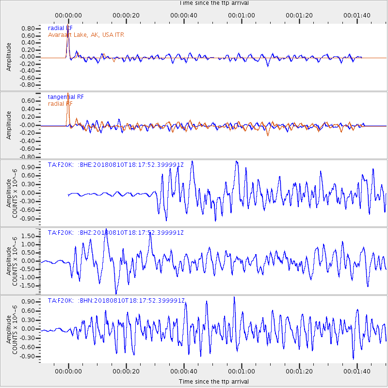
F20K Avaraart Lake, AK, USA - Earthquake Result Viewer
*The percent match for this event was below the threshold and hence no stack was calculated.
| Earthquake location: |
Kuril Islands |
| Earthquake latitude/longitude: |
48.5/154.8 |
| Earthquake time(UTC): |
2018/08/10 (222) 18:12:05 GMT |
| Earthquake Depth: |
16 km |
| Earthquake Magnitude: |
5.9 Mww |
| Earthquake Catalog/Contributor: |
NEIC PDE/us |
|
| Network: |
TA USArray Transportable Network (new EarthScope stations) |
| Station: |
F20K Avaraart Lake, AK, USA |
| Lat/Lon: |
67.05 N/155.73 W |
| Elevation: |
136 m |
|
| Distance: |
31.1 deg |
| Az: |
35.242 deg |
| Baz: |
258.294 deg |
| Ray Param: |
$rayparam |
*The percent match for this event was below the threshold and hence was not used in the summary stack. |
|
| Radial Match: |
73.626366 % |
| Radial Bump: |
400 |
| Transverse Match: |
62.459576 % |
| Transverse Bump: |
400 |
| SOD ConfigId: |
13570011 |
| Insert Time: |
2019-04-30 18:40:03.324 +0000 |
| GWidth: |
2.5 |
| Max Bumps: |
400 |
| Tol: |
0.001 |
|
Signal To Noise
| Channel | StoN | STA | LTA |
| TA:F20K: :BHZ:20180810T18:17:52.399991Z | 10.914417 | 5.769008E-7 | 5.2856766E-8 |
| TA:F20K: :BHN:20180810T18:17:52.399991Z | 2.7660644 | 1.2102335E-7 | 4.37529E-8 |
| TA:F20K: :BHE:20180810T18:17:52.399991Z | 11.88838 | 4.477646E-7 | 3.7664055E-8 |
| Arrivals |
| Ps | |
| PpPs | |
| PsPs/PpSs | |


