You are here: Home > Network List > TA - USArray Transportable Network (new EarthScope stations) Stations List
> Station X20A Quemado, NM, USA > Earthquake Result Viewer
X20A Quemado, NM, USA - Earthquake Result Viewer

| Earthquake location: |
Central Mid-Atlantic Ridge |
| Earthquake latitude/longitude: |
8.1/-38.7 |
| Earthquake time(UTC): |
2008/09/10 (254) 13:08:14 GMT |
| Earthquake Depth: |
10 km |
| Earthquake Magnitude: |
6.3 MB, 6.5 MS, 6.6 MW, 6.6 MW |
| Earthquake Catalog/Contributor: |
WHDF/NEIC |
|
| Network: |
TA USArray Transportable Network (new EarthScope stations) |
| Station: |
X20A Quemado, NM, USA |
| Lat/Lon: |
34.54 N/108.50 W |
| Elevation: |
2057 m |
|
| Distance: |
68.8 deg |
| Az: |
303.822 deg |
| Baz: |
94.782 deg |
| Ray Param: |
0.056059323 |
| Estimated Moho Depth: |
51.75 km |
| Estimated Crust Vp/Vs: |
1.61 |
| Assumed Crust Vp: |
6.496 km/s |
| Estimated Crust Vs: |
4.035 km/s |
| Estimated Crust Poisson's Ratio: |
0.19 |
|
| Radial Match: |
83.98322 % |
| Radial Bump: |
357 |
| Transverse Match: |
85.00951 % |
| Transverse Bump: |
299 |
| SOD ConfigId: |
2560 |
| Insert Time: |
2010-03-06 13:42:18.720 +0000 |
| GWidth: |
2.5 |
| Max Bumps: |
400 |
| Tol: |
0.001 |
|
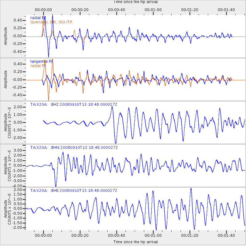
Signal To Noise
| Channel | StoN | STA | LTA |
| TA:X20A: :BHN:20080910T13:18:48.000027Z | 2.5049984 | 2.2999599E-7 | 9.1814826E-8 |
| TA:X20A: :BHE:20080910T13:18:48.000027Z | 0.38417926 | 1.03214134E-7 | 2.6866138E-7 |
| TA:X20A: :BHZ:20080910T13:18:48.000027Z | 1.1444085 | 1.8398336E-7 | 1.6076721E-7 |
| Arrivals |
| Ps | 5.1 SECOND |
| PpPs | 20 SECOND |
| PsPs/PpSs | 25 SECOND |


