You are here: Home > Network List > US - United States National Seismic Network Stations List
> Station EGMT Eagleton, Montana, USA > Earthquake Result Viewer
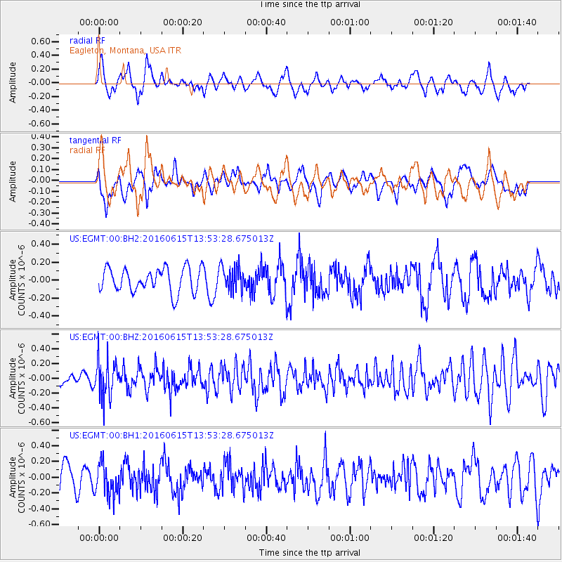
EGMT Eagleton, Montana, USA - Earthquake Result Viewer
*The percent match for this event was below the threshold and hence no stack was calculated.
| Earthquake location: |
Guatemala |
| Earthquake latitude/longitude: |
14.2/-91.5 |
| Earthquake time(UTC): |
2016/06/15 (167) 13:46:56 GMT |
| Earthquake Depth: |
70 km |
| Earthquake Magnitude: |
5.7 MB |
| Earthquake Catalog/Contributor: |
NEIC PDE/NEIC COMCAT |
|
| Network: |
US United States National Seismic Network |
| Station: |
EGMT Eagleton, Montana, USA |
| Lat/Lon: |
48.02 N/109.75 W |
| Elevation: |
1055 m |
|
| Distance: |
37.0 deg |
| Az: |
339.479 deg |
| Baz: |
149.577 deg |
| Ray Param: |
$rayparam |
*The percent match for this event was below the threshold and hence was not used in the summary stack. |
|
| Radial Match: |
57.50808 % |
| Radial Bump: |
400 |
| Transverse Match: |
57.806503 % |
| Transverse Bump: |
400 |
| SOD ConfigId: |
1634031 |
| Insert Time: |
2016-06-29 13:48:39.704 +0000 |
| GWidth: |
2.5 |
| Max Bumps: |
400 |
| Tol: |
0.001 |
|
Signal To Noise
| Channel | StoN | STA | LTA |
| US:EGMT:00:BHZ:20160615T13:53:28.675013Z | 3.284145 | 2.5564103E-7 | 7.784097E-8 |
| US:EGMT:00:BH1:20160615T13:53:28.675013Z | 1.3190893 | 1.99347E-7 | 1.5112472E-7 |
| US:EGMT:00:BH2:20160615T13:53:28.675013Z | 1.0000892 | 1.3407904E-7 | 1.340671E-7 |
| Arrivals |
| Ps | |
| PpPs | |
| PsPs/PpSs | |


