
X20A Quemado, NM, USA - Earthquake Result Viewer
| ||||||||||||||||||
| ||||||||||||||||||
| ||||||||||||||||||
|
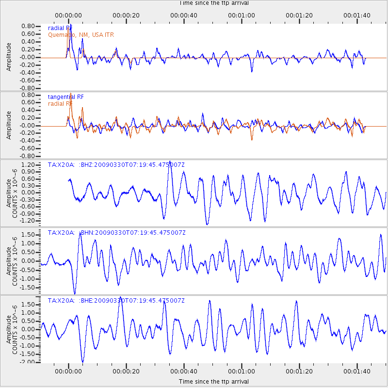
Signal To Noise
| Channel | StoN | STA | LTA |
| TA:X20A: :BHN:20090330T07:19:45.475007Z | 5.6629567 | 9.920817E-7 | 1.7518794E-7 |
| TA:X20A: :BHE:20090330T07:19:45.475007Z | 2.7528665 | 7.634886E-7 | 2.773431E-7 |
| TA:X20A: :BHZ:20090330T07:19:45.475007Z | 2.1519825 | 5.5359465E-7 | 2.5724867E-7 |
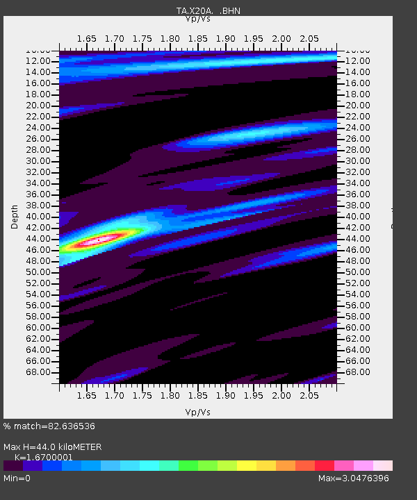
| Arrivals | |
| Ps | 4.9 SECOND |
| PpPs | 17 SECOND |
| PsPs/PpSs | 22 SECOND |

