You are here: Home > Network List > US - United States National Seismic Network Stations List
> Station MSO Missoula, Montana, USA > Earthquake Result Viewer
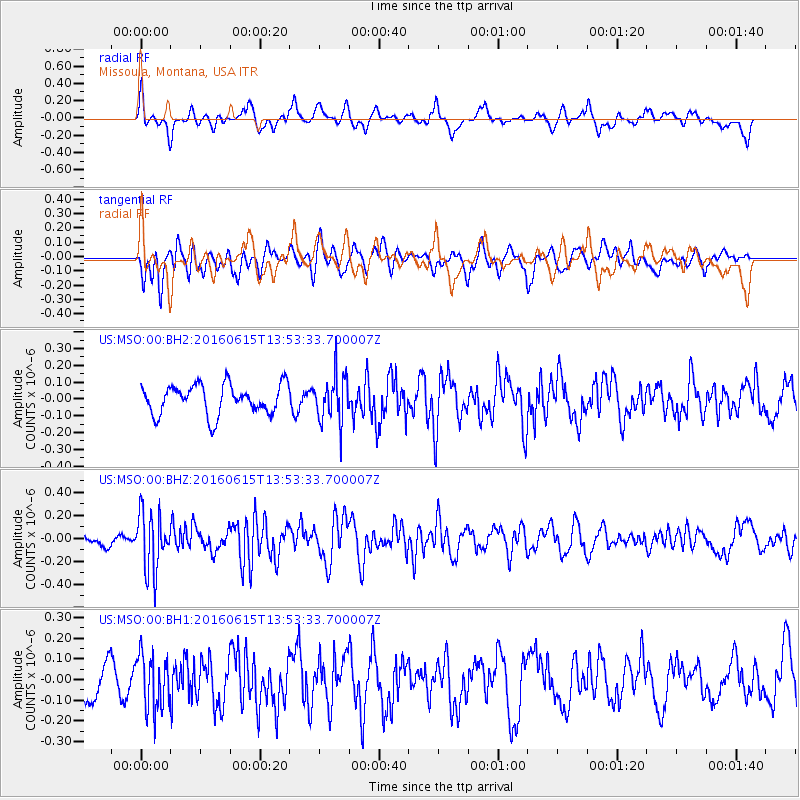
MSO Missoula, Montana, USA - Earthquake Result Viewer
*The percent match for this event was below the threshold and hence no stack was calculated.
| Earthquake location: |
Guatemala |
| Earthquake latitude/longitude: |
14.2/-91.5 |
| Earthquake time(UTC): |
2016/06/15 (167) 13:46:56 GMT |
| Earthquake Depth: |
70 km |
| Earthquake Magnitude: |
5.7 MB |
| Earthquake Catalog/Contributor: |
NEIC PDE/NEIC COMCAT |
|
| Network: |
US United States National Seismic Network |
| Station: |
MSO Missoula, Montana, USA |
| Lat/Lon: |
46.83 N/113.94 W |
| Elevation: |
1264 m |
|
| Distance: |
37.6 deg |
| Az: |
334.482 deg |
| Baz: |
142.525 deg |
| Ray Param: |
$rayparam |
*The percent match for this event was below the threshold and hence was not used in the summary stack. |
|
| Radial Match: |
60.06033 % |
| Radial Bump: |
400 |
| Transverse Match: |
56.92161 % |
| Transverse Bump: |
400 |
| SOD ConfigId: |
1634031 |
| Insert Time: |
2016-06-29 13:48:49.735 +0000 |
| GWidth: |
2.5 |
| Max Bumps: |
400 |
| Tol: |
0.001 |
|
Signal To Noise
| Channel | StoN | STA | LTA |
| US:MSO:00:BHZ:20160615T13:53:33.700007Z | 2.823594 | 2.5492636E-7 | 9.028435E-8 |
| US:MSO:00:BH1:20160615T13:53:33.700007Z | 1.0977124 | 1.3273241E-7 | 1.2091729E-7 |
| US:MSO:00:BH2:20160615T13:53:33.700007Z | 1.5667936 | 1.382415E-7 | 8.823211E-8 |
| Arrivals |
| Ps | |
| PpPs | |
| PsPs/PpSs | |


