You are here: Home > Network List > UW - Pacific Northwest Regional Seismic Network Stations List
> Station FISH Seaside, OR, USA > Earthquake Result Viewer
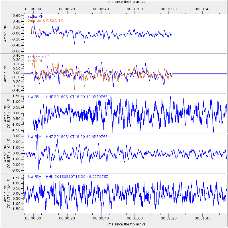
FISH Seaside, OR, USA - Earthquake Result Viewer
*The percent match for this event was below the threshold and hence no stack was calculated.
| Earthquake location: |
Kuril Islands |
| Earthquake latitude/longitude: |
48.5/154.8 |
| Earthquake time(UTC): |
2018/08/10 (222) 18:12:05 GMT |
| Earthquake Depth: |
16 km |
| Earthquake Magnitude: |
5.9 Mww |
| Earthquake Catalog/Contributor: |
NEIC PDE/us |
|
| Network: |
UW Pacific Northwest Regional Seismic Network |
| Station: |
FISH Seaside, OR, USA |
| Lat/Lon: |
45.93 N/123.56 W |
| Elevation: |
325 m |
|
| Distance: |
53.0 deg |
| Az: |
59.85 deg |
| Baz: |
304.459 deg |
| Ray Param: |
$rayparam |
*The percent match for this event was below the threshold and hence was not used in the summary stack. |
|
| Radial Match: |
64.17525 % |
| Radial Bump: |
400 |
| Transverse Match: |
64.39447 % |
| Transverse Bump: |
400 |
| SOD ConfigId: |
13570011 |
| Insert Time: |
2019-04-30 18:42:35.781 +0000 |
| GWidth: |
2.5 |
| Max Bumps: |
400 |
| Tol: |
0.001 |
|
Signal To Noise
| Channel | StoN | STA | LTA |
| UW:FISH: :HHZ:20180810T18:20:49.927976Z | 6.8323855 | 1.3226694E-6 | 1.9358824E-7 |
| UW:FISH: :HHN:20180810T18:20:49.927976Z | 1.2457052 | 4.687795E-7 | 3.7631654E-7 |
| UW:FISH: :HHE:20180810T18:20:49.927976Z | 0.81529355 | 4.0907562E-7 | 5.0175254E-7 |
| Arrivals |
| Ps | |
| PpPs | |
| PsPs/PpSs | |


