X20A Quemado, NM, USA - Earthquake Result Viewer
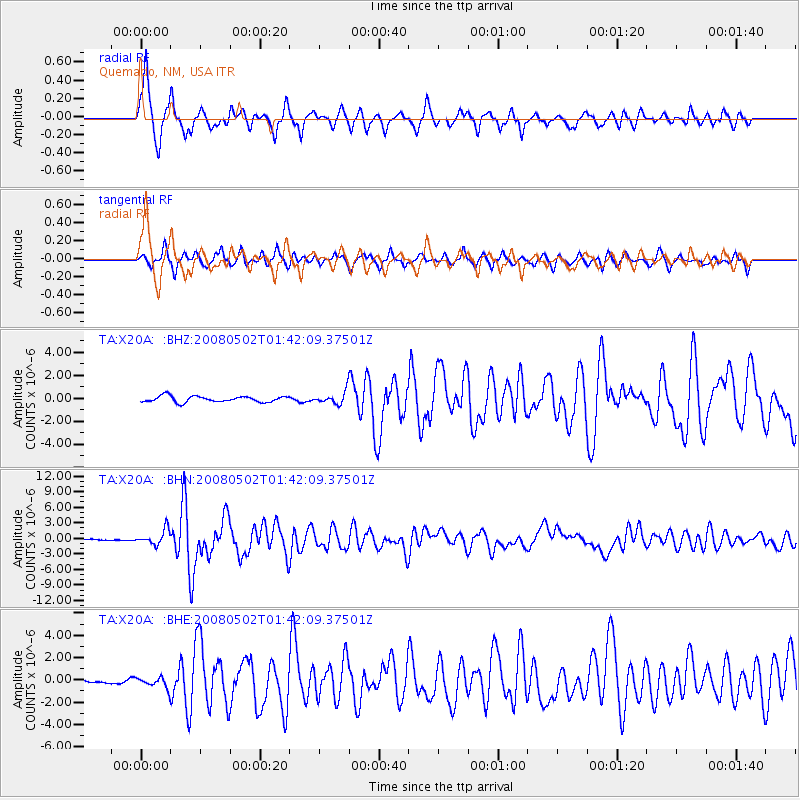
Earthquake location: Andreanof Islands, Aleutian Is.
Earthquake latitude/longitude: 51.9/-177.5
Earthquake time(UTC): 2008/05/02 (123) 01:33:37 GMT
Earthquake Depth: 14 km
Earthquake Magnitude: 6.3 MB, 6.8 MS, 6.6 MW, 6.6 MW
Earthquake Catalog/Contributor: WHDF/NEIC
Network: TA USArray Transportable Network (new EarthScope stations)
Station: X20A Quemado, NM, USA
Lat/Lon: 34.54 N/108.50 W
Elevation: 2057 m
Distance: 51.2 deg
Az: 81.28 deg
Baz: 312.055 deg
Ray Param: 0.06752576
Estimated Moho Depth: 43.25 km
Estimated Crust Vp/Vs: 1.75
Assumed Crust Vp: 6.496 km/s
Estimated Crust Vs: 3.712 km/s
Estimated Crust Poisson's Ratio: 0.26
Radial Match: 93.33223 %
Radial Bump: 364
Transverse Match: 86.74868 %
Transverse Bump: 366
SOD ConfigId: 2504
Insert Time: 2010-03-06 13:43:24.740 +0000
GWidth: 2.5
Max Bumps: 400
Tol: 0.001

Signal To Noise

ChannelStoNSTALTA
TA:X20A: :BHN:20080502T01:42:09.37501Z8.503721.4417238E-61.6954037E-7
TA:X20A: :BHE:20080502T01:42:09.37501Z2.09277444.7378327E-72.2639004E-7
TA:X20A: :BHZ:20080502T01:42:09.37501Z2.0600235.4374607E-72.6395145E-7
Arrivals
Ps5.3 SECOND
PpPs17 SECOND
PsPs/PpSs23 SECOND