You are here: Home > Network List > TA - USArray Transportable Network (new EarthScope stations) Stations List
> Station X20A Quemado, NM, USA > Earthquake Result Viewer
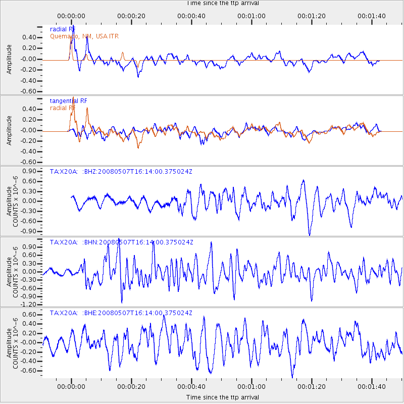
X20A Quemado, NM, USA - Earthquake Result Viewer
*The percent match for this event was below the threshold and hence no stack was calculated.
| Earthquake location: |
Near East Coast Of Honshu, Japan |
| Earthquake latitude/longitude: |
36.2/141.5 |
| Earthquake time(UTC): |
2008/05/07 (128) 16:02:02 GMT |
| Earthquake Depth: |
19 km |
| Earthquake Magnitude: |
5.7 MB, 6.2 MW, 6.2 MW |
| Earthquake Catalog/Contributor: |
WHDF/NEIC |
|
| Network: |
TA USArray Transportable Network (new EarthScope stations) |
| Station: |
X20A Quemado, NM, USA |
| Lat/Lon: |
34.54 N/108.50 W |
| Elevation: |
2057 m |
|
| Distance: |
84.0 deg |
| Az: |
51.272 deg |
| Baz: |
310.127 deg |
| Ray Param: |
$rayparam |
*The percent match for this event was below the threshold and hence was not used in the summary stack. |
|
| Radial Match: |
75.10551 % |
| Radial Bump: |
400 |
| Transverse Match: |
62.891796 % |
| Transverse Bump: |
400 |
| SOD ConfigId: |
2504 |
| Insert Time: |
2010-03-06 13:43:56.356 +0000 |
| GWidth: |
2.5 |
| Max Bumps: |
400 |
| Tol: |
0.001 |
|
Signal To Noise
| Channel | StoN | STA | LTA |
| TA:X20A: :BHN:20080507T16:14:00.375024Z | 3.5422456 | 1.6951495E-7 | 4.7855224E-8 |
| TA:X20A: :BHE:20080507T16:14:00.375024Z | 1.3543266 | 2.1724543E-7 | 1.6040845E-7 |
| TA:X20A: :BHZ:20080507T16:14:00.375024Z | 0.9321782 | 1.0800617E-7 | 1.15864296E-7 |
| Arrivals |
| Ps | |
| PpPs | |
| PsPs/PpSs | |


