You are here: Home > Network List > TA - USArray Transportable Network (new EarthScope stations) Stations List
> Station X20A Quemado, NM, USA > Earthquake Result Viewer
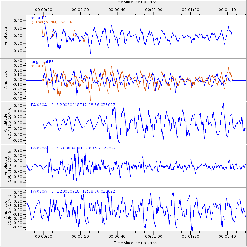
X20A Quemado, NM, USA - Earthquake Result Viewer
*The percent match for this event was below the threshold and hence no stack was calculated.
| Earthquake location: |
Near East Coast Of Kamchatka |
| Earthquake latitude/longitude: |
51.9/158.4 |
| Earthquake time(UTC): |
2008/09/18 (262) 11:58:50 GMT |
| Earthquake Depth: |
67 km |
| Earthquake Magnitude: |
5.7 MB, 5.9 MW, 5.8 MW |
| Earthquake Catalog/Contributor: |
WHDF/NEIC |
|
| Network: |
TA USArray Transportable Network (new EarthScope stations) |
| Station: |
X20A Quemado, NM, USA |
| Lat/Lon: |
34.54 N/108.50 W |
| Elevation: |
2057 m |
|
| Distance: |
65.5 deg |
| Az: |
64.975 deg |
| Baz: |
317.17 deg |
| Ray Param: |
$rayparam |
*The percent match for this event was below the threshold and hence was not used in the summary stack. |
|
| Radial Match: |
52.725483 % |
| Radial Bump: |
400 |
| Transverse Match: |
53.692917 % |
| Transverse Bump: |
400 |
| SOD ConfigId: |
2560 |
| Insert Time: |
2010-03-06 13:44:24.909 +0000 |
| GWidth: |
2.5 |
| Max Bumps: |
400 |
| Tol: |
0.001 |
|
Signal To Noise
| Channel | StoN | STA | LTA |
| TA:X20A: :BHN:20080918T12:08:56.02502Z | 3.6784973 | 3.5811908E-7 | 9.735472E-8 |
| TA:X20A: :BHE:20080918T12:08:56.02502Z | 0.7473214 | 1.317766E-7 | 1.7633188E-7 |
| TA:X20A: :BHZ:20080918T12:08:56.02502Z | 1.1900836 | 1.5622571E-7 | 1.3127288E-7 |
| Arrivals |
| Ps | |
| PpPs | |
| PsPs/PpSs | |


