You are here: Home > Network List > TA - USArray Transportable Network (new EarthScope stations) Stations List
> Station X20A Quemado, NM, USA > Earthquake Result Viewer
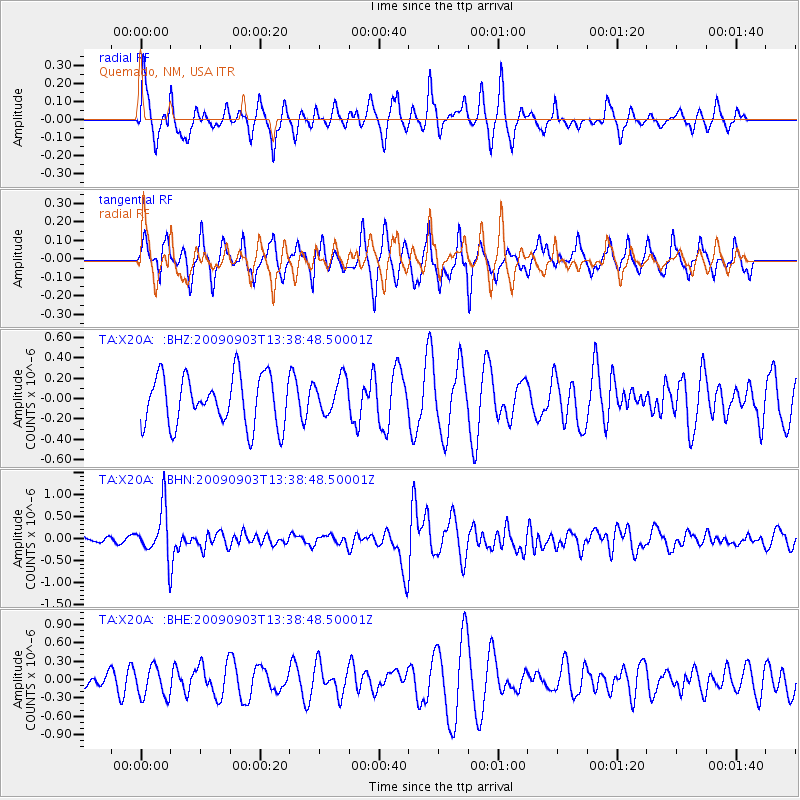
X20A Quemado, NM, USA - Earthquake Result Viewer
*The percent match for this event was below the threshold and hence no stack was calculated.
| Earthquake location: |
Kyushu, Japan |
| Earthquake latitude/longitude: |
31.1/130.0 |
| Earthquake time(UTC): |
2009/09/03 (246) 13:26:18 GMT |
| Earthquake Depth: |
166 km |
| Earthquake Magnitude: |
5.9 MB, 6.2 MW, 6.2 MW |
| Earthquake Catalog/Contributor: |
WHDF/NEIC |
|
| Network: |
TA USArray Transportable Network (new EarthScope stations) |
| Station: |
X20A Quemado, NM, USA |
| Lat/Lon: |
34.54 N/108.50 W |
| Elevation: |
2057 m |
|
| Distance: |
94.5 deg |
| Az: |
44.928 deg |
| Baz: |
312.816 deg |
| Ray Param: |
$rayparam |
*The percent match for this event was below the threshold and hence was not used in the summary stack. |
|
| Radial Match: |
57.263454 % |
| Radial Bump: |
314 |
| Transverse Match: |
61.022 % |
| Transverse Bump: |
363 |
| SOD ConfigId: |
2622 |
| Insert Time: |
2010-03-06 13:44:37.447 +0000 |
| GWidth: |
2.5 |
| Max Bumps: |
400 |
| Tol: |
0.001 |
|
Signal To Noise
| Channel | StoN | STA | LTA |
| TA:X20A: :BHN:20090903T13:38:48.50001Z | 6.5330777 | 5.5362557E-7 | 8.474193E-8 |
| TA:X20A: :BHE:20090903T13:38:48.50001Z | 0.97839683 | 2.4700506E-7 | 2.52459E-7 |
| TA:X20A: :BHZ:20090903T13:38:48.50001Z | 0.721282 | 1.750111E-7 | 2.4263895E-7 |
| Arrivals |
| Ps | |
| PpPs | |
| PsPs/PpSs | |


