You are here: Home > Network List > TA - USArray Transportable Network (new EarthScope stations) Stations List
> Station X20A Quemado, NM, USA > Earthquake Result Viewer
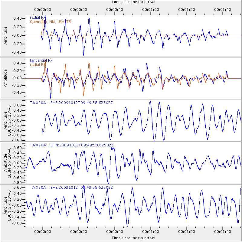
X20A Quemado, NM, USA - Earthquake Result Viewer
*The percent match for this event was below the threshold and hence no stack was calculated.
| Earthquake location: |
Santa Cruz Islands |
| Earthquake latitude/longitude: |
-12.4/166.5 |
| Earthquake time(UTC): |
2009/10/12 (285) 09:37:21 GMT |
| Earthquake Depth: |
42 km |
| Earthquake Magnitude: |
5.9 MB, 5.9 MS, 6.2 MW, 6.2 MW |
| Earthquake Catalog/Contributor: |
WHDF/NEIC |
|
| Network: |
TA USArray Transportable Network (new EarthScope stations) |
| Station: |
X20A Quemado, NM, USA |
| Lat/Lon: |
34.54 N/108.50 W |
| Elevation: |
2057 m |
|
| Distance: |
92.9 deg |
| Az: |
55.426 deg |
| Baz: |
257.019 deg |
| Ray Param: |
$rayparam |
*The percent match for this event was below the threshold and hence was not used in the summary stack. |
|
| Radial Match: |
59.517277 % |
| Radial Bump: |
341 |
| Transverse Match: |
66.18474 % |
| Transverse Bump: |
328 |
| SOD ConfigId: |
2622 |
| Insert Time: |
2010-03-06 13:44:54.809 +0000 |
| GWidth: |
2.5 |
| Max Bumps: |
400 |
| Tol: |
0.001 |
|
Signal To Noise
| Channel | StoN | STA | LTA |
| TA:X20A: :BHN:20091012T09:49:58.62502Z | 2.4424922 | 2.4434905E-7 | 1.0004088E-7 |
| TA:X20A: :BHE:20091012T09:49:58.62502Z | 1.0078831 | 1.4468277E-7 | 1.4355115E-7 |
| TA:X20A: :BHZ:20091012T09:49:58.62502Z | 1.0199972 | 2.2106687E-7 | 2.1673281E-7 |
| Arrivals |
| Ps | |
| PpPs | |
| PsPs/PpSs | |


