You are here: Home > Network List > TA - USArray Transportable Network (new EarthScope stations) Stations List
> Station X20A Quemado, NM, USA > Earthquake Result Viewer
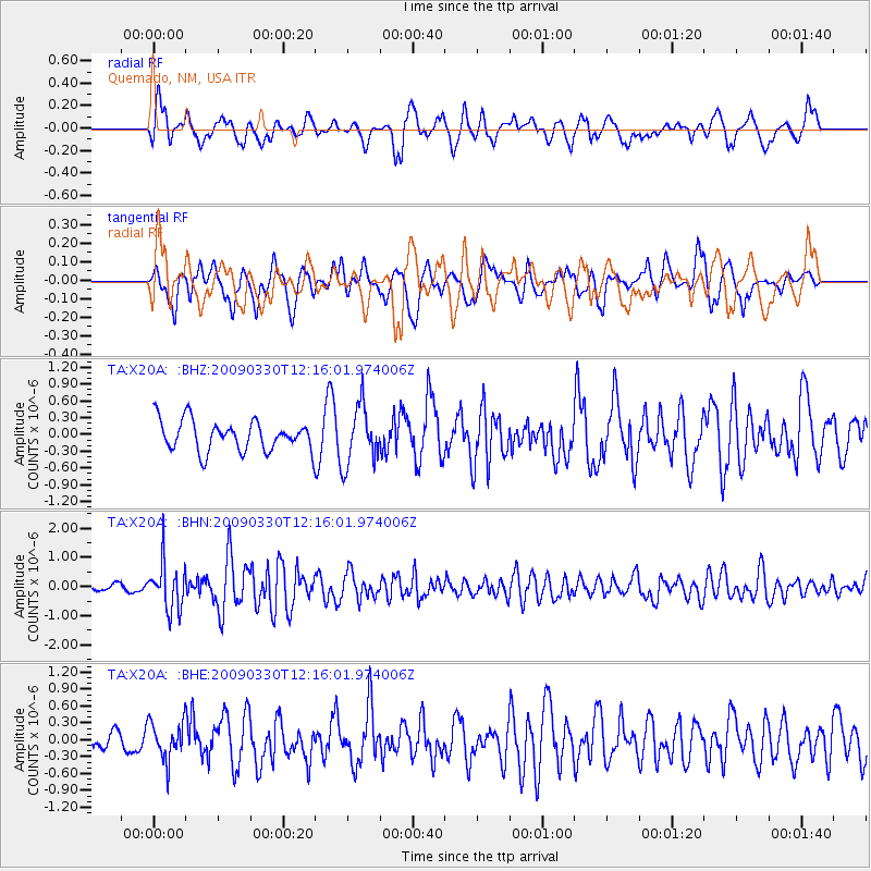
X20A Quemado, NM, USA - Earthquake Result Viewer
*The percent match for this event was below the threshold and hence no stack was calculated.
| Earthquake location: |
Andreanof Islands, Aleutian Is. |
| Earthquake latitude/longitude: |
51.5/-178.3 |
| Earthquake time(UTC): |
2009/03/30 (089) 12:07:28 GMT |
| Earthquake Depth: |
31 km |
| Earthquake Magnitude: |
6.0 MB, 5.5 MS, 5.7 MW, 5.7 MW |
| Earthquake Catalog/Contributor: |
WHDF/NEIC |
|
| Network: |
TA USArray Transportable Network (new EarthScope stations) |
| Station: |
X20A Quemado, NM, USA |
| Lat/Lon: |
34.54 N/108.50 W |
| Elevation: |
2057 m |
|
| Distance: |
51.7 deg |
| Az: |
80.507 deg |
| Baz: |
311.731 deg |
| Ray Param: |
$rayparam |
*The percent match for this event was below the threshold and hence was not used in the summary stack. |
|
| Radial Match: |
59.401814 % |
| Radial Bump: |
400 |
| Transverse Match: |
55.95235 % |
| Transverse Bump: |
400 |
| SOD ConfigId: |
2658 |
| Insert Time: |
2010-03-06 13:45:32.682 +0000 |
| GWidth: |
2.5 |
| Max Bumps: |
400 |
| Tol: |
0.001 |
|
Signal To Noise
| Channel | StoN | STA | LTA |
| TA:X20A: :BHN:20090330T12:16:01.974006Z | 7.246639 | 7.989543E-7 | 1.1025171E-7 |
| TA:X20A: :BHE:20090330T12:16:01.974006Z | 1.9340396 | 3.3718047E-7 | 1.7434E-7 |
| TA:X20A: :BHZ:20090330T12:16:01.974006Z | 1.9467843 | 5.233782E-7 | 2.6884243E-7 |
| Arrivals |
| Ps | |
| PpPs | |
| PsPs/PpSs | |


