You are here: Home > Network List > TA - USArray Transportable Network (new EarthScope stations) Stations List
> Station X20A Quemado, NM, USA > Earthquake Result Viewer
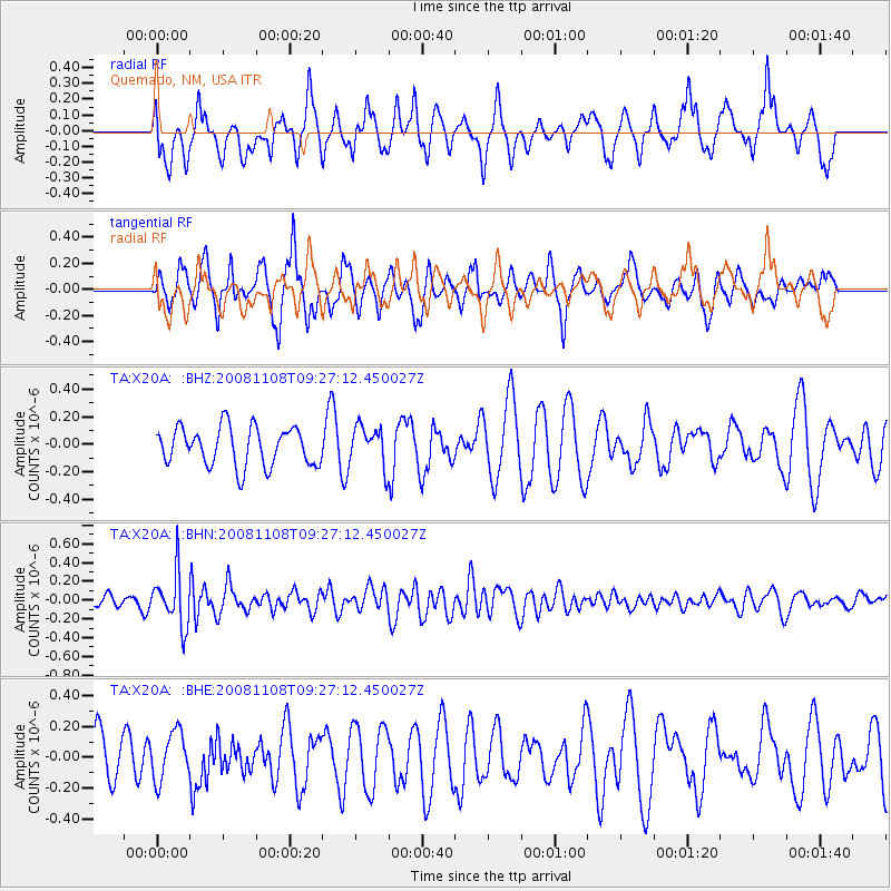
X20A Quemado, NM, USA - Earthquake Result Viewer
*The percent match for this event was below the threshold and hence no stack was calculated.
| Earthquake location: |
Tonga Islands |
| Earthquake latitude/longitude: |
-15.2/-174.2 |
| Earthquake time(UTC): |
2008/11/08 (313) 09:15:51 GMT |
| Earthquake Depth: |
140 km |
| Earthquake Magnitude: |
5.5 MW, 5.3 MB |
| Earthquake Catalog/Contributor: |
WHDF/NEIC |
|
| Network: |
TA USArray Transportable Network (new EarthScope stations) |
| Station: |
X20A Quemado, NM, USA |
| Lat/Lon: |
34.54 N/108.50 W |
| Elevation: |
2057 m |
|
| Distance: |
79.6 deg |
| Az: |
49.907 deg |
| Baz: |
243.462 deg |
| Ray Param: |
$rayparam |
*The percent match for this event was below the threshold and hence was not used in the summary stack. |
|
| Radial Match: |
46.94491 % |
| Radial Bump: |
400 |
| Transverse Match: |
56.21359 % |
| Transverse Bump: |
364 |
| SOD ConfigId: |
2658 |
| Insert Time: |
2010-03-06 13:45:34.777 +0000 |
| GWidth: |
2.5 |
| Max Bumps: |
400 |
| Tol: |
0.001 |
|
Signal To Noise
| Channel | StoN | STA | LTA |
| TA:X20A: :BHN:20081108T09:27:12.450027Z | 3.6778345 | 2.7942332E-7 | 7.597495E-8 |
| TA:X20A: :BHE:20081108T09:27:12.450027Z | 0.99837244 | 1.5557535E-7 | 1.5582897E-7 |
| TA:X20A: :BHZ:20081108T09:27:12.450027Z | 1.045561 | 1.4500753E-7 | 1.3868873E-7 |
| Arrivals |
| Ps | |
| PpPs | |
| PsPs/PpSs | |


