You are here: Home > Network List > TA - USArray Transportable Network (new EarthScope stations) Stations List
> Station X20A Quemado, NM, USA > Earthquake Result Viewer
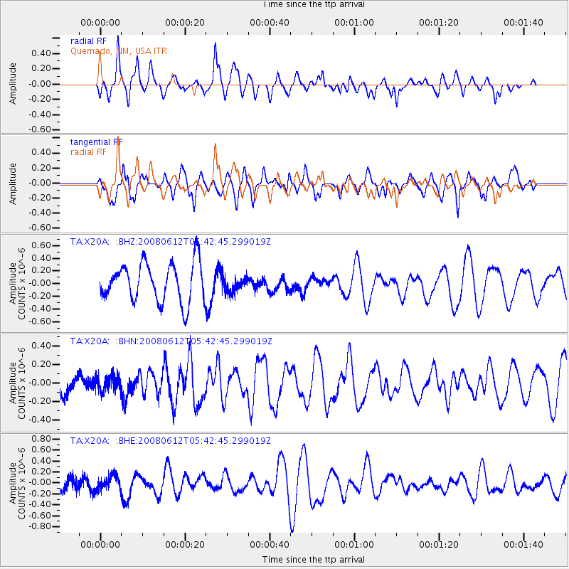
X20A Quemado, NM, USA - Earthquake Result Viewer
*The percent match for this event was below the threshold and hence no stack was calculated.
| Earthquake location: |
Southern East Pacific Rise |
| Earthquake latitude/longitude: |
-50.2/-114.2 |
| Earthquake time(UTC): |
2008/06/12 (164) 05:30:43 GMT |
| Earthquake Depth: |
10 km |
| Earthquake Magnitude: |
5.6 MS, 5.3 MB, 5.9 MW, 5.9 MW |
| Earthquake Catalog/Contributor: |
WHDF/NEIC |
|
| Network: |
TA USArray Transportable Network (new EarthScope stations) |
| Station: |
X20A Quemado, NM, USA |
| Lat/Lon: |
34.54 N/108.50 W |
| Elevation: |
2057 m |
|
| Distance: |
84.5 deg |
| Az: |
4.701 deg |
| Baz: |
183.661 deg |
| Ray Param: |
$rayparam |
*The percent match for this event was below the threshold and hence was not used in the summary stack. |
|
| Radial Match: |
55.26266 % |
| Radial Bump: |
400 |
| Transverse Match: |
65.978195 % |
| Transverse Bump: |
400 |
| SOD ConfigId: |
2504 |
| Insert Time: |
2010-03-06 13:46:00.663 +0000 |
| GWidth: |
2.5 |
| Max Bumps: |
400 |
| Tol: |
0.001 |
|
Signal To Noise
| Channel | StoN | STA | LTA |
| TA:X20A: :BHN:20080612T05:42:45.299019Z | 0.44655856 | 8.006402E-8 | 1.7929119E-7 |
| TA:X20A: :BHE:20080612T05:42:45.299019Z | 0.57654524 | 1.2769162E-7 | 2.2147721E-7 |
| TA:X20A: :BHZ:20080612T05:42:45.299019Z | 0.38020563 | 1.1550074E-7 | 3.0378493E-7 |
| Arrivals |
| Ps | |
| PpPs | |
| PsPs/PpSs | |


