You are here: Home > Network List > TA - USArray Transportable Network (new EarthScope stations) Stations List
> Station X20A Quemado, NM, USA > Earthquake Result Viewer
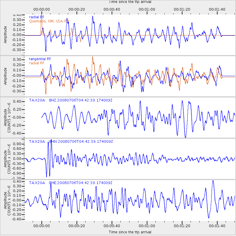
X20A Quemado, NM, USA - Earthquake Result Viewer
*The percent match for this event was below the threshold and hence no stack was calculated.
| Earthquake location: |
South Of Fiji Islands |
| Earthquake latitude/longitude: |
-25.5/-176.4 |
| Earthquake time(UTC): |
2008/07/06 (188) 04:30:26 GMT |
| Earthquake Depth: |
49 km |
| Earthquake Magnitude: |
5.5 MB, 5.3 MS |
| Earthquake Catalog/Contributor: |
WHDF/NEIC |
|
| Network: |
TA USArray Transportable Network (new EarthScope stations) |
| Station: |
X20A Quemado, NM, USA |
| Lat/Lon: |
34.54 N/108.50 W |
| Elevation: |
2057 m |
|
| Distance: |
87.7 deg |
| Az: |
49.924 deg |
| Baz: |
236.928 deg |
| Ray Param: |
$rayparam |
*The percent match for this event was below the threshold and hence was not used in the summary stack. |
|
| Radial Match: |
56.39643 % |
| Radial Bump: |
400 |
| Transverse Match: |
64.41578 % |
| Transverse Bump: |
357 |
| SOD ConfigId: |
2504 |
| Insert Time: |
2010-03-06 13:46:05.337 +0000 |
| GWidth: |
2.5 |
| Max Bumps: |
400 |
| Tol: |
0.001 |
|
Signal To Noise
| Channel | StoN | STA | LTA |
| TA:X20A: :BHN:20080706T04:42:39.174009Z | 7.544549 | 5.0321125E-7 | 6.669866E-8 |
| TA:X20A: :BHE:20080706T04:42:39.174009Z | 1.0156955 | 9.6607415E-8 | 9.511455E-8 |
| TA:X20A: :BHZ:20080706T04:42:39.174009Z | 0.42179987 | 6.455069E-8 | 1.530363E-7 |
| Arrivals |
| Ps | |
| PpPs | |
| PsPs/PpSs | |


