You are here: Home > Network List > II - Global Seismograph Network (GSN - IRIS/IDA) Stations List
> Station WRAB Tennant Creek, NT, Australia > Earthquake Result Viewer
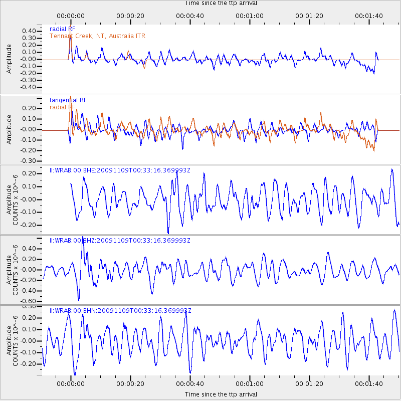
WRAB Tennant Creek, NT, Australia - Earthquake Result Viewer
*The percent match for this event was below the threshold and hence no stack was calculated.
| Earthquake location: |
Prince Edward Islands Region |
| Earthquake latitude/longitude: |
-43.5/39.6 |
| Earthquake time(UTC): |
2009/11/09 (313) 00:21:38 GMT |
| Earthquake Depth: |
10 km |
| Earthquake Magnitude: |
5.5 MB, 5.3 MS, 5.6 MW |
| Earthquake Catalog/Contributor: |
WHDF/NEIC |
|
| Network: |
II Global Seismograph Network (GSN - IRIS/IDA) |
| Station: |
WRAB Tennant Creek, NT, Australia |
| Lat/Lon: |
19.93 S/134.36 E |
| Elevation: |
366 m |
|
| Distance: |
79.9 deg |
| Az: |
107.751 deg |
| Baz: |
227.484 deg |
| Ray Param: |
$rayparam |
*The percent match for this event was below the threshold and hence was not used in the summary stack. |
|
| Radial Match: |
48.319378 % |
| Radial Bump: |
400 |
| Transverse Match: |
52.109707 % |
| Transverse Bump: |
400 |
| SOD ConfigId: |
1 |
| Insert Time: |
2010-02-19 01:07:53.764 +0000 |
| GWidth: |
2.5 |
| Max Bumps: |
400 |
| Tol: |
0.001 |
|
Signal To Noise
| Channel | StoN | STA | LTA |
| II:WRAB:00:BHZ:20091109T00:33:16.369993Z | 2.9496636 | 2.8942713E-7 | 9.812208E-8 |
| II:WRAB:00:BHN:20091109T00:33:16.369993Z | 1.8153135 | 1.7993709E-7 | 9.912177E-8 |
| II:WRAB:00:BHE:20091109T00:33:16.369993Z | 1.3420049 | 1.0827557E-7 | 8.068195E-8 |
| Arrivals |
| Ps | |
| PpPs | |
| PsPs/PpSs | |


