You are here: Home > Network List > TA - USArray Transportable Network (new EarthScope stations) Stations List
> Station X20A Quemado, NM, USA > Earthquake Result Viewer
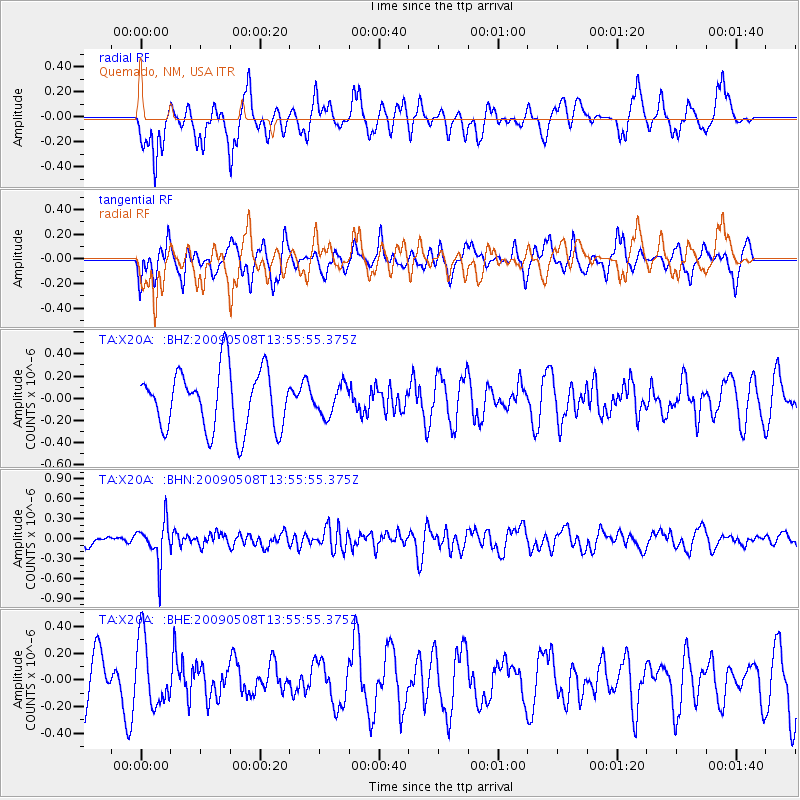
X20A Quemado, NM, USA - Earthquake Result Viewer
*The percent match for this event was below the threshold and hence no stack was calculated.
| Earthquake location: |
Mendoza Province, Argentina |
| Earthquake latitude/longitude: |
-32.1/-69.7 |
| Earthquake time(UTC): |
2009/05/08 (128) 13:44:53 GMT |
| Earthquake Depth: |
112 km |
| Earthquake Magnitude: |
5.6 MB, 5.4 MW |
| Earthquake Catalog/Contributor: |
WHDF/NEIC |
|
| Network: |
TA USArray Transportable Network (new EarthScope stations) |
| Station: |
X20A Quemado, NM, USA |
| Lat/Lon: |
34.54 N/108.50 W |
| Elevation: |
2057 m |
|
| Distance: |
75.6 deg |
| Az: |
327.713 deg |
| Baz: |
146.67 deg |
| Ray Param: |
$rayparam |
*The percent match for this event was below the threshold and hence was not used in the summary stack. |
|
| Radial Match: |
49.147312 % |
| Radial Bump: |
331 |
| Transverse Match: |
57.84379 % |
| Transverse Bump: |
381 |
| SOD ConfigId: |
2658 |
| Insert Time: |
2010-03-06 13:46:16.452 +0000 |
| GWidth: |
2.5 |
| Max Bumps: |
400 |
| Tol: |
0.001 |
|
Signal To Noise
| Channel | StoN | STA | LTA |
| TA:X20A: :BHN:20090508T13:55:55.375Z | 2.7149365 | 2.984323E-7 | 1.0992239E-7 |
| TA:X20A: :BHE:20090508T13:55:55.375Z | 1.2455544 | 2.514226E-7 | 2.0185595E-7 |
| TA:X20A: :BHZ:20090508T13:55:55.375Z | 0.48295906 | 1.3122794E-7 | 2.717165E-7 |
| Arrivals |
| Ps | |
| PpPs | |
| PsPs/PpSs | |


