You are here: Home > Network List > G - GEOSCOPE Stations List
> Station MPG Montagne des Peres, French Guyana > Earthquake Result Viewer
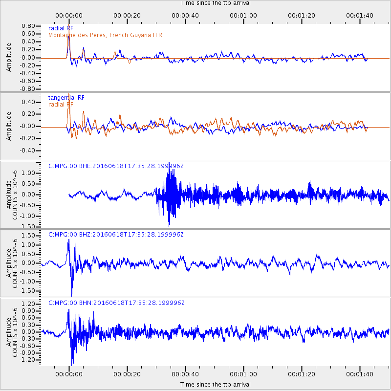
MPG Montagne des Peres, French Guyana - Earthquake Result Viewer
*The percent match for this event was below the threshold and hence no stack was calculated.
| Earthquake location: |
Chile-Argentina Border Region |
| Earthquake latitude/longitude: |
-24.2/-67.1 |
| Earthquake time(UTC): |
2016/06/18 (170) 17:29:44 GMT |
| Earthquake Depth: |
167 km |
| Earthquake Magnitude: |
5.5 MB |
| Earthquake Catalog/Contributor: |
NEIC PDE/NEIC COMCAT |
|
| Network: |
G GEOSCOPE |
| Station: |
MPG Montagne des Peres, French Guyana |
| Lat/Lon: |
5.11 N/52.64 W |
| Elevation: |
147 m |
|
| Distance: |
32.4 deg |
| Az: |
27.653 deg |
| Baz: |
205.178 deg |
| Ray Param: |
$rayparam |
*The percent match for this event was below the threshold and hence was not used in the summary stack. |
|
| Radial Match: |
73.702324 % |
| Radial Bump: |
400 |
| Transverse Match: |
46.904984 % |
| Transverse Bump: |
400 |
| SOD ConfigId: |
1634031 |
| Insert Time: |
2016-07-02 17:31:56.733 +0000 |
| GWidth: |
2.5 |
| Max Bumps: |
400 |
| Tol: |
0.001 |
|
Signal To Noise
| Channel | StoN | STA | LTA |
| G:MPG:00:BHZ:20160618T17:35:28.199996Z | 7.539304 | 6.1585337E-7 | 8.1685705E-8 |
| G:MPG:00:BHN:20160618T17:35:28.199996Z | 7.9085493 | 5.191423E-7 | 6.564318E-8 |
| G:MPG:00:BHE:20160618T17:35:28.199996Z | 4.4487576 | 4.913881E-7 | 1.1045512E-7 |
| Arrivals |
| Ps | |
| PpPs | |
| PsPs/PpSs | |


