You are here: Home > Network List > TA - USArray Transportable Network (new EarthScope stations) Stations List
> Station X20A Quemado, NM, USA > Earthquake Result Viewer
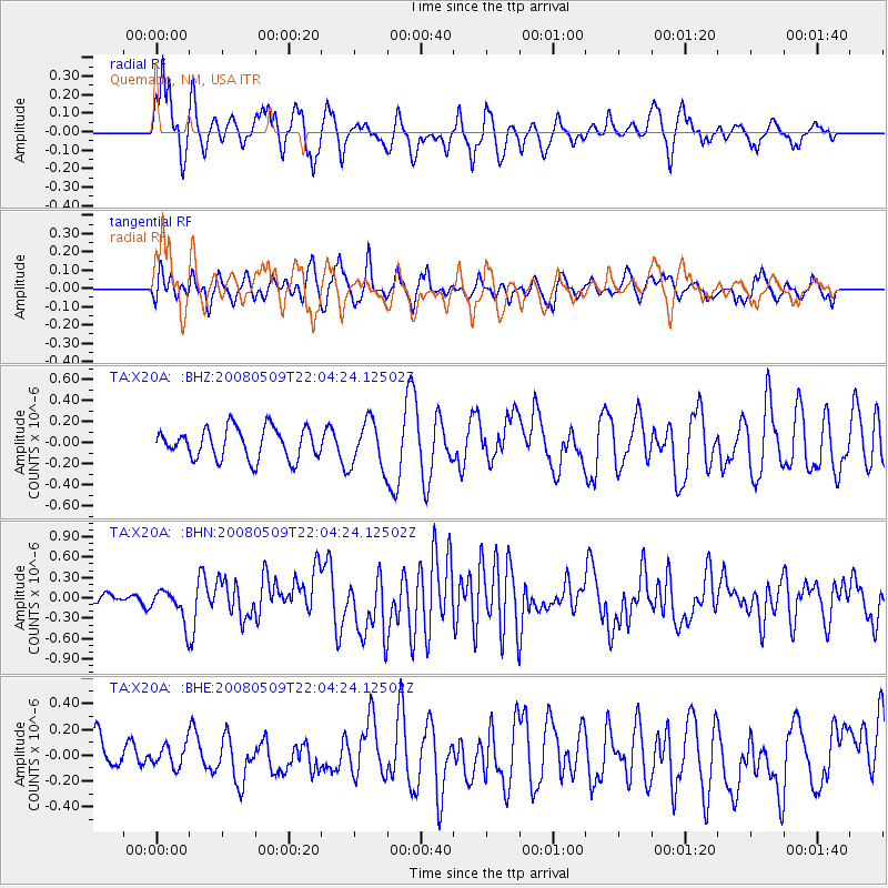
X20A Quemado, NM, USA - Earthquake Result Viewer
*The percent match for this event was below the threshold and hence no stack was calculated.
| Earthquake location: |
South Of Mariana Islands |
| Earthquake latitude/longitude: |
12.5/143.2 |
| Earthquake time(UTC): |
2008/05/09 (130) 21:51:29 GMT |
| Earthquake Depth: |
76 km |
| Earthquake Magnitude: |
6.1 MB, 6.7 MW, 6.7 MW |
| Earthquake Catalog/Contributor: |
WHDF/NEIC |
|
| Network: |
TA USArray Transportable Network (new EarthScope stations) |
| Station: |
X20A Quemado, NM, USA |
| Lat/Lon: |
34.54 N/108.50 W |
| Elevation: |
2057 m |
|
| Distance: |
97.6 deg |
| Az: |
52.236 deg |
| Baz: |
290.738 deg |
| Ray Param: |
$rayparam |
*The percent match for this event was below the threshold and hence was not used in the summary stack. |
|
| Radial Match: |
69.75394 % |
| Radial Bump: |
400 |
| Transverse Match: |
63.928547 % |
| Transverse Bump: |
400 |
| SOD ConfigId: |
2504 |
| Insert Time: |
2010-03-06 13:46:36.676 +0000 |
| GWidth: |
2.5 |
| Max Bumps: |
400 |
| Tol: |
0.001 |
|
Signal To Noise
| Channel | StoN | STA | LTA |
| TA:X20A: :BHN:20080509T22:04:24.12502Z | 2.7831662 | 2.3701168E-7 | 8.5159016E-8 |
| TA:X20A: :BHE:20080509T22:04:24.12502Z | 0.4951566 | 8.989924E-8 | 1.8155718E-7 |
| TA:X20A: :BHZ:20080509T22:04:24.12502Z | 1.5187 | 2.1912237E-7 | 1.4428285E-7 |
| Arrivals |
| Ps | |
| PpPs | |
| PsPs/PpSs | |


