You are here: Home > Network List > AZ - ANZA Regional Network Stations List
> Station SMER AZ.SMER > Earthquake Result Viewer
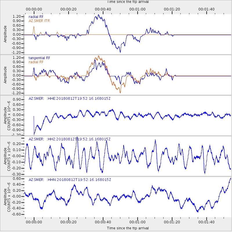
SMER AZ.SMER - Earthquake Result Viewer
*The percent match for this event was below the threshold and hence no stack was calculated.
| Earthquake location: |
Southeast Of Easter Island |
| Earthquake latitude/longitude: |
-35.7/-102.4 |
| Earthquake time(UTC): |
2018/08/12 (224) 19:41:34 GMT |
| Earthquake Depth: |
10 km |
| Earthquake Magnitude: |
5.6 Mww |
| Earthquake Catalog/Contributor: |
NEIC PDE/us |
|
| Network: |
AZ ANZA Regional Network |
| Station: |
SMER AZ.SMER |
| Lat/Lon: |
33.46 N/117.17 W |
| Elevation: |
355 m |
|
| Distance: |
70.2 deg |
| Az: |
346.878 deg |
| Baz: |
167.228 deg |
| Ray Param: |
$rayparam |
*The percent match for this event was below the threshold and hence was not used in the summary stack. |
|
| Radial Match: |
19.60628 % |
| Radial Bump: |
400 |
| Transverse Match: |
21.216139 % |
| Transverse Bump: |
400 |
| SOD ConfigId: |
13570011 |
| Insert Time: |
2019-04-30 19:06:15.884 +0000 |
| GWidth: |
2.5 |
| Max Bumps: |
400 |
| Tol: |
0.001 |
|
Signal To Noise
| Channel | StoN | STA | LTA |
| AZ:SMER: :HHZ:20180812T19:52:16.168015Z | 0.760775 | 8.585845E-8 | 1.1285656E-7 |
| AZ:SMER: :HHN:20180812T19:52:16.168015Z | 0.27227694 | 1.3716837E-7 | 5.0378253E-7 |
| AZ:SMER: :HHE:20180812T19:52:16.168015Z | 1.244294 | 3.732334E-7 | 2.9995596E-7 |
| Arrivals |
| Ps | |
| PpPs | |
| PsPs/PpSs | |


