You are here: Home > Network List > CI - Caltech Regional Seismic Network Stations List
> Station MPP McPhearson Peak > Earthquake Result Viewer
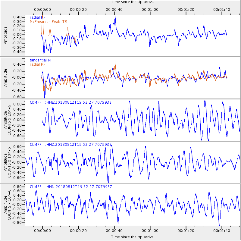
MPP McPhearson Peak - Earthquake Result Viewer
*The percent match for this event was below the threshold and hence no stack was calculated.
| Earthquake location: |
Southeast Of Easter Island |
| Earthquake latitude/longitude: |
-35.7/-102.4 |
| Earthquake time(UTC): |
2018/08/12 (224) 19:41:34 GMT |
| Earthquake Depth: |
10 km |
| Earthquake Magnitude: |
5.6 Mww |
| Earthquake Catalog/Contributor: |
NEIC PDE/us |
|
| Network: |
CI Caltech Regional Seismic Network |
| Station: |
MPP McPhearson Peak |
| Lat/Lon: |
34.89 N/119.81 W |
| Elevation: |
1739 m |
|
| Distance: |
72.1 deg |
| Az: |
344.989 deg |
| Baz: |
165.139 deg |
| Ray Param: |
$rayparam |
*The percent match for this event was below the threshold and hence was not used in the summary stack. |
|
| Radial Match: |
47.63736 % |
| Radial Bump: |
400 |
| Transverse Match: |
65.913246 % |
| Transverse Bump: |
400 |
| SOD ConfigId: |
13570011 |
| Insert Time: |
2019-04-30 19:06:49.101 +0000 |
| GWidth: |
2.5 |
| Max Bumps: |
400 |
| Tol: |
0.001 |
|
Signal To Noise
| Channel | StoN | STA | LTA |
| CI:MPP: :HHZ:20180812T19:52:27.707993Z | 0.7306023 | 1.9572067E-7 | 2.678895E-7 |
| CI:MPP: :HHN:20180812T19:52:27.707993Z | 1.8086449 | 3.3645313E-7 | 1.8602496E-7 |
| CI:MPP: :HHE:20180812T19:52:27.707993Z | 1.1067038 | 2.711899E-7 | 2.4504288E-7 |
| Arrivals |
| Ps | |
| PpPs | |
| PsPs/PpSs | |


